You are here: Home > Network List > TA - USArray Transportable Network (new EarthScope stations) Stations List
> Station I23K Minto, Yukon-Koyukuk, AK, USA > Earthquake Result Viewer
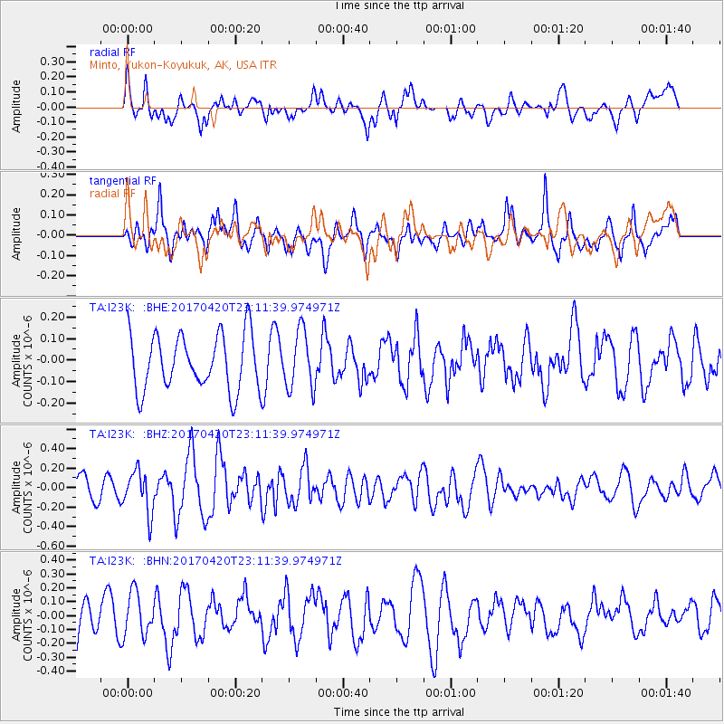
I23K Minto, Yukon-Koyukuk, AK, USA - Earthquake Result Viewer
*The percent match for this event was below the threshold and hence no stack was calculated.
| Earthquake location: |
Tonga Islands |
| Earthquake latitude/longitude: |
-20.5/-173.6 |
| Earthquake time(UTC): |
2017/04/20 (110) 22:59:24 GMT |
| Earthquake Depth: |
13 km |
| Earthquake Magnitude: |
5.6 Mww |
| Earthquake Catalog/Contributor: |
NEIC PDE/us |
|
| Network: |
TA USArray Transportable Network (new EarthScope stations) |
| Station: |
I23K Minto, Yukon-Koyukuk, AK, USA |
| Lat/Lon: |
65.15 N/149.36 W |
| Elevation: |
149 m |
|
| Distance: |
87.4 deg |
| Az: |
10.002 deg |
| Baz: |
202.655 deg |
| Ray Param: |
$rayparam |
*The percent match for this event was below the threshold and hence was not used in the summary stack. |
|
| Radial Match: |
39.91737 % |
| Radial Bump: |
398 |
| Transverse Match: |
60.682297 % |
| Transverse Bump: |
400 |
| SOD ConfigId: |
11737051 |
| Insert Time: |
2019-04-27 04:15:05.360 +0000 |
| GWidth: |
2.5 |
| Max Bumps: |
400 |
| Tol: |
0.001 |
|
Signal To Noise
| Channel | StoN | STA | LTA |
| TA:I23K: :BHZ:20170420T23:11:39.974971Z | 2.12409 | 2.1726912E-7 | 1.022881E-7 |
| TA:I23K: :BHN:20170420T23:11:39.974971Z | 1.029612 | 1.5363219E-7 | 1.4921369E-7 |
| TA:I23K: :BHE:20170420T23:11:39.974971Z | 1.0622498 | 1.3751765E-7 | 1.2945887E-7 |
| Arrivals |
| Ps | |
| PpPs | |
| PsPs/PpSs | |


