You are here: Home > Network List > TA - USArray Transportable Network (new EarthScope stations) Stations List
> Station 129A Stewart Farms, Lamesa, TX, USA > Earthquake Result Viewer
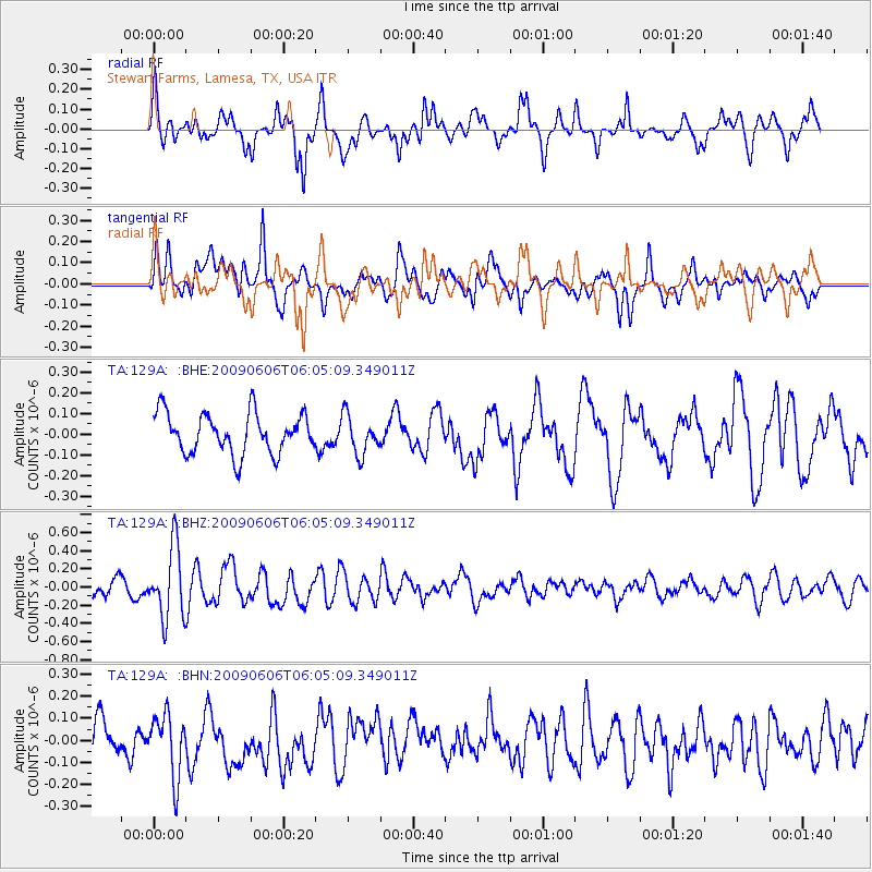
129A Stewart Farms, Lamesa, TX, USA - Earthquake Result Viewer
*The percent match for this event was below the threshold and hence no stack was calculated.
| Earthquake location: |
Near East Coast Of Honshu, Japan |
| Earthquake latitude/longitude: |
35.5/140.9 |
| Earthquake time(UTC): |
2009/06/06 (157) 05:52:43 GMT |
| Earthquake Depth: |
34 km |
| Earthquake Magnitude: |
5.8 MB, 5.4 MS, 5.8 MW, 5.7 MW |
| Earthquake Catalog/Contributor: |
WHDF/NEIC |
|
| Network: |
TA USArray Transportable Network (new EarthScope stations) |
| Station: |
129A Stewart Farms, Lamesa, TX, USA |
| Lat/Lon: |
32.63 N/101.87 W |
| Elevation: |
876 m |
|
| Distance: |
90.3 deg |
| Az: |
48.622 deg |
| Baz: |
313.468 deg |
| Ray Param: |
$rayparam |
*The percent match for this event was below the threshold and hence was not used in the summary stack. |
|
| Radial Match: |
78.16996 % |
| Radial Bump: |
400 |
| Transverse Match: |
73.17684 % |
| Transverse Bump: |
400 |
| SOD ConfigId: |
2648 |
| Insert Time: |
2010-03-05 23:16:24.264 +0000 |
| GWidth: |
2.5 |
| Max Bumps: |
400 |
| Tol: |
0.001 |
|
Signal To Noise
| Channel | StoN | STA | LTA |
| TA:129A: :BHZ:20090606T06:05:09.349011Z | 4.495079 | 3.925802E-7 | 8.733555E-8 |
| TA:129A: :BHN:20090606T06:05:09.349011Z | 1.775525 | 1.410767E-7 | 7.945633E-8 |
| TA:129A: :BHE:20090606T06:05:09.349011Z | 0.98206455 | 9.526466E-8 | 9.7004474E-8 |
| Arrivals |
| Ps | |
| PpPs | |
| PsPs/PpSs | |


