You are here: Home > Network List > GS - US Geological Survey Networks Stations List
> Station KAN13 Rinehart Farm > Earthquake Result Viewer
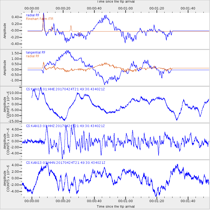
KAN13 Rinehart Farm - Earthquake Result Viewer
*The percent match for this event was below the threshold and hence no stack was calculated.
| Earthquake location: |
Off Coast Of Central Chile |
| Earthquake latitude/longitude: |
-33.0/-72.0 |
| Earthquake time(UTC): |
2017/04/24 (114) 21:38:24 GMT |
| Earthquake Depth: |
33 km |
| Earthquake Magnitude: |
6.7 Mi |
| Earthquake Catalog/Contributor: |
NEIC PDE/at |
|
| Network: |
GS US Geological Survey Networks |
| Station: |
KAN13 Rinehart Farm |
| Lat/Lon: |
37.01 N/97.48 W |
| Elevation: |
340 m |
|
| Distance: |
73.6 deg |
| Az: |
338.966 deg |
| Baz: |
157.864 deg |
| Ray Param: |
$rayparam |
*The percent match for this event was below the threshold and hence was not used in the summary stack. |
|
| Radial Match: |
68.34018 % |
| Radial Bump: |
400 |
| Transverse Match: |
33.422085 % |
| Transverse Bump: |
400 |
| SOD ConfigId: |
11737051 |
| Insert Time: |
2019-04-27 04:38:21.094 +0000 |
| GWidth: |
2.5 |
| Max Bumps: |
400 |
| Tol: |
0.001 |
|
Signal To Noise
| Channel | StoN | STA | LTA |
| GS:KAN13:01:HHZ:20170424T21:49:30.434021Z | 0.5481024 | 2.620085E-7 | 4.7802837E-7 |
| GS:KAN13:01:HHN:20170424T21:49:30.434021Z | 2.033423 | 3.1667694E-6 | 1.5573589E-6 |
| GS:KAN13:01:HHE:20170424T21:49:30.434021Z | 0.9903649 | 7.723699E-6 | 7.798842E-6 |
| Arrivals |
| Ps | |
| PpPs | |
| PsPs/PpSs | |


