You are here: Home > Network List > US - United States National Seismic Network Stations List
> Station CBKS Cedar Bluff, Kansas, USA > Earthquake Result Viewer
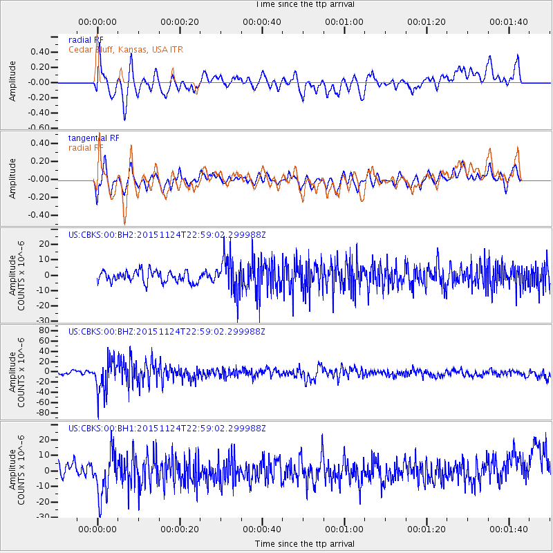
CBKS Cedar Bluff, Kansas, USA - Earthquake Result Viewer
*The percent match for this event was below the threshold and hence no stack was calculated.
| Earthquake location: |
Peru-Brazil Border Region |
| Earthquake latitude/longitude: |
-10.1/-71.1 |
| Earthquake time(UTC): |
2015/11/24 (328) 22:50:53 GMT |
| Earthquake Depth: |
595 km |
| Earthquake Magnitude: |
5.9 MB |
| Earthquake Catalog/Contributor: |
NEIC PDE/NEIC COMCAT |
|
| Network: |
US United States National Seismic Network |
| Station: |
CBKS Cedar Bluff, Kansas, USA |
| Lat/Lon: |
38.81 N/99.74 W |
| Elevation: |
677 m |
|
| Distance: |
55.5 deg |
| Az: |
332.96 deg |
| Baz: |
145.04 deg |
| Ray Param: |
$rayparam |
*The percent match for this event was below the threshold and hence was not used in the summary stack. |
|
| Radial Match: |
59.563534 % |
| Radial Bump: |
400 |
| Transverse Match: |
53.198853 % |
| Transverse Bump: |
400 |
| SOD ConfigId: |
1259291 |
| Insert Time: |
2015-12-09 00:04:07.178 +0000 |
| GWidth: |
2.5 |
| Max Bumps: |
400 |
| Tol: |
0.001 |
|
Signal To Noise
| Channel | StoN | STA | LTA |
| US:CBKS:00:BHZ:20151124T22:59:02.299988Z | 10.333259 | 3.1775355E-5 | 3.0750566E-6 |
| US:CBKS:00:BH1:20151124T22:59:02.299988Z | 3.2246757 | 1.4447739E-5 | 4.4803696E-6 |
| US:CBKS:00:BH2:20151124T22:59:02.299988Z | 3.062019 | 1.1166928E-5 | 3.6469164E-6 |
| Arrivals |
| Ps | |
| PpPs | |
| PsPs/PpSs | |


