You are here: Home > Network List > US - United States National Seismic Network Stations List
> Station MNTX Cornudas Mountains, Texas, USA > Earthquake Result Viewer
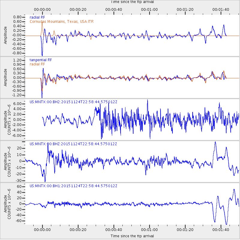
MNTX Cornudas Mountains, Texas, USA - Earthquake Result Viewer
*The percent match for this event was below the threshold and hence no stack was calculated.
| Earthquake location: |
Peru-Brazil Border Region |
| Earthquake latitude/longitude: |
-10.1/-71.1 |
| Earthquake time(UTC): |
2015/11/24 (328) 22:50:53 GMT |
| Earthquake Depth: |
595 km |
| Earthquake Magnitude: |
5.9 MB |
| Earthquake Catalog/Contributor: |
NEIC PDE/NEIC COMCAT |
|
| Network: |
US United States National Seismic Network |
| Station: |
MNTX Cornudas Mountains, Texas, USA |
| Lat/Lon: |
31.70 N/105.38 W |
| Elevation: |
404 m |
|
| Distance: |
53.0 deg |
| Az: |
323.002 deg |
| Baz: |
135.958 deg |
| Ray Param: |
$rayparam |
*The percent match for this event was below the threshold and hence was not used in the summary stack. |
|
| Radial Match: |
55.29604 % |
| Radial Bump: |
346 |
| Transverse Match: |
65.06614 % |
| Transverse Bump: |
400 |
| SOD ConfigId: |
1259291 |
| Insert Time: |
2015-12-09 00:06:17.293 +0000 |
| GWidth: |
2.5 |
| Max Bumps: |
400 |
| Tol: |
0.001 |
|
Signal To Noise
| Channel | StoN | STA | LTA |
| US:MNTX:00:BHZ:20151124T22:58:44.575012Z | 8.097401 | 1.69419E-5 | 2.0922641E-6 |
| US:MNTX:00:BH1:20151124T22:58:44.575012Z | 4.200573 | 6.7295605E-6 | 1.6020579E-6 |
| US:MNTX:00:BH2:20151124T22:58:44.575012Z | 3.3212798 | 3.4907516E-6 | 1.0510261E-6 |
| Arrivals |
| Ps | |
| PpPs | |
| PsPs/PpSs | |


