You are here: Home > Network List > AZ - ANZA Regional Network Stations List
> Station LVA2 AZ.LVA2 > Earthquake Result Viewer
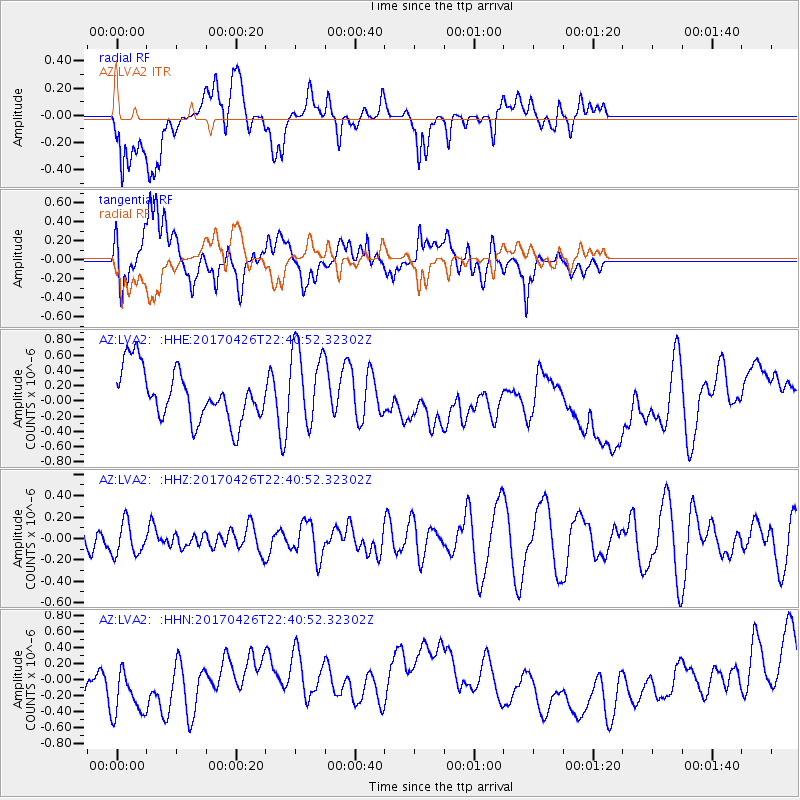
LVA2 AZ.LVA2 - Earthquake Result Viewer
*The percent match for this event was below the threshold and hence no stack was calculated.
| Earthquake location: |
Pacific-Antarctic Ridge |
| Earthquake latitude/longitude: |
-54.9/-130.3 |
| Earthquake time(UTC): |
2017/04/26 (116) 22:28:30 GMT |
| Earthquake Depth: |
10 km |
| Earthquake Magnitude: |
5.5 Mwb |
| Earthquake Catalog/Contributor: |
NEIC PDE/us |
|
| Network: |
AZ ANZA Regional Network |
| Station: |
LVA2 AZ.LVA2 |
| Lat/Lon: |
33.35 N/116.56 W |
| Elevation: |
1435 m |
|
| Distance: |
88.7 deg |
| Az: |
11.471 deg |
| Baz: |
187.893 deg |
| Ray Param: |
$rayparam |
*The percent match for this event was below the threshold and hence was not used in the summary stack. |
|
| Radial Match: |
40.862335 % |
| Radial Bump: |
400 |
| Transverse Match: |
36.5321 % |
| Transverse Bump: |
400 |
| SOD ConfigId: |
11737051 |
| Insert Time: |
2019-04-27 04:58:39.049 +0000 |
| GWidth: |
2.5 |
| Max Bumps: |
400 |
| Tol: |
0.001 |
|
Signal To Noise
| Channel | StoN | STA | LTA |
| AZ:LVA2: :HHZ:20170426T22:40:52.32302Z | 0.7157152 | 1.5299662E-7 | 2.1376745E-7 |
| AZ:LVA2: :HHN:20170426T22:40:52.32302Z | 1.5170218 | 3.4693718E-7 | 2.2869625E-7 |
| AZ:LVA2: :HHE:20170426T22:40:52.32302Z | 1.5234828 | 5.1091155E-7 | 3.353576E-7 |
| Arrivals |
| Ps | |
| PpPs | |
| PsPs/PpSs | |


