You are here: Home > Network List > TA - USArray Transportable Network (new EarthScope stations) Stations List
> Station 121A Cookes Peak, Deming, NM, USA > Earthquake Result Viewer
121A Cookes Peak, Deming, NM, USA - Earthquake Result Viewer
*The percent match for this event was below the threshold and hence no stack was calculated.
| Earthquake location: |
Rat Islands, Aleutian Islands |
| Earthquake latitude/longitude: |
51.3/178.6 |
| Earthquake time(UTC): |
2017/04/27 (117) 14:46:33 GMT |
| Earthquake Depth: |
19 km |
| Earthquake Magnitude: |
5.7 Mww |
| Earthquake Catalog/Contributor: |
NEIC PDE/us |
|
| Network: |
TA USArray Transportable Network (new EarthScope stations) |
| Station: |
121A Cookes Peak, Deming, NM, USA |
| Lat/Lon: |
32.53 N/107.79 W |
| Elevation: |
1652 m |
|
| Distance: |
55.5 deg |
| Az: |
79.46 deg |
| Baz: |
313.001 deg |
| Ray Param: |
$rayparam |
*The percent match for this event was below the threshold and hence was not used in the summary stack. |
|
| Radial Match: |
39.361923 % |
| Radial Bump: |
400 |
| Transverse Match: |
54.855255 % |
| Transverse Bump: |
373 |
| SOD ConfigId: |
11737051 |
| Insert Time: |
2019-04-27 05:13:01.799 +0000 |
| GWidth: |
2.5 |
| Max Bumps: |
400 |
| Tol: |
0.001 |
|
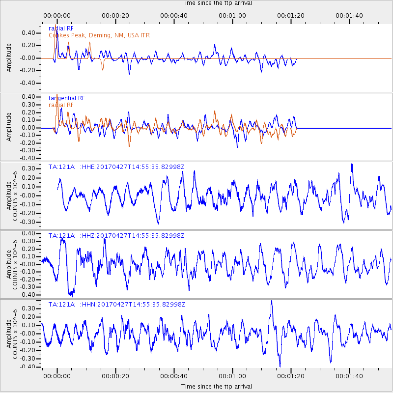
Signal To Noise
| Channel | StoN | STA | LTA |
| TA:121A: :HHZ:20170427T14:55:35.82998Z | 3.2635872 | 2.641001E-7 | 8.092325E-8 |
| TA:121A: :HHN:20170427T14:55:35.82998Z | 1.1227994 | 7.5595565E-8 | 6.7327754E-8 |
| TA:121A: :HHE:20170427T14:55:35.82998Z | 1.7008466 | 1.4990714E-7 | 8.813678E-8 |
| Arrivals |
| Ps | |
| PpPs | |
| PsPs/PpSs | |


