You are here: Home > Network List > CI - Caltech Regional Seismic Network Stations List
> Station SLA SLA, Trona, CA, USA > Earthquake Result Viewer
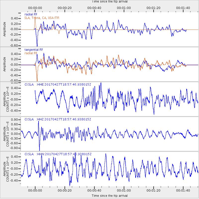
SLA SLA, Trona, CA, USA - Earthquake Result Viewer
*The percent match for this event was below the threshold and hence no stack was calculated.
| Earthquake location: |
Tonga Islands |
| Earthquake latitude/longitude: |
-16.5/-173.7 |
| Earthquake time(UTC): |
2017/04/27 (117) 18:46:42 GMT |
| Earthquake Depth: |
33 km |
| Earthquake Magnitude: |
5.5 mb |
| Earthquake Catalog/Contributor: |
NEIC PDE/us |
|
| Network: |
CI Caltech Regional Seismic Network |
| Station: |
SLA SLA, Trona, CA, USA |
| Lat/Lon: |
35.89 N/117.28 W |
| Elevation: |
1174 m |
|
| Distance: |
74.6 deg |
| Az: |
44.554 deg |
| Baz: |
235.98 deg |
| Ray Param: |
$rayparam |
*The percent match for this event was below the threshold and hence was not used in the summary stack. |
|
| Radial Match: |
61.586567 % |
| Radial Bump: |
400 |
| Transverse Match: |
44.112885 % |
| Transverse Bump: |
400 |
| SOD ConfigId: |
11737051 |
| Insert Time: |
2019-04-27 05:18:44.745 +0000 |
| GWidth: |
2.5 |
| Max Bumps: |
400 |
| Tol: |
0.001 |
|
Signal To Noise
| Channel | StoN | STA | LTA |
| CI:SLA: :HHZ:20170427T18:57:46.938015Z | 2.9650955 | 3.5518173E-7 | 1.1978761E-7 |
| CI:SLA: :HHN:20170427T18:57:46.938015Z | 1.4164891 | 1.8159278E-7 | 1.281992E-7 |
| CI:SLA: :HHE:20170427T18:57:46.938015Z | 1.265953 | 2.47975E-7 | 1.9588012E-7 |
| Arrivals |
| Ps | |
| PpPs | |
| PsPs/PpSs | |


