You are here: Home > Network List > GM - US Geological Survey Networks Stations List
> Station IWM01 Jericho 2M Well Monitoring Station > Earthquake Result Viewer
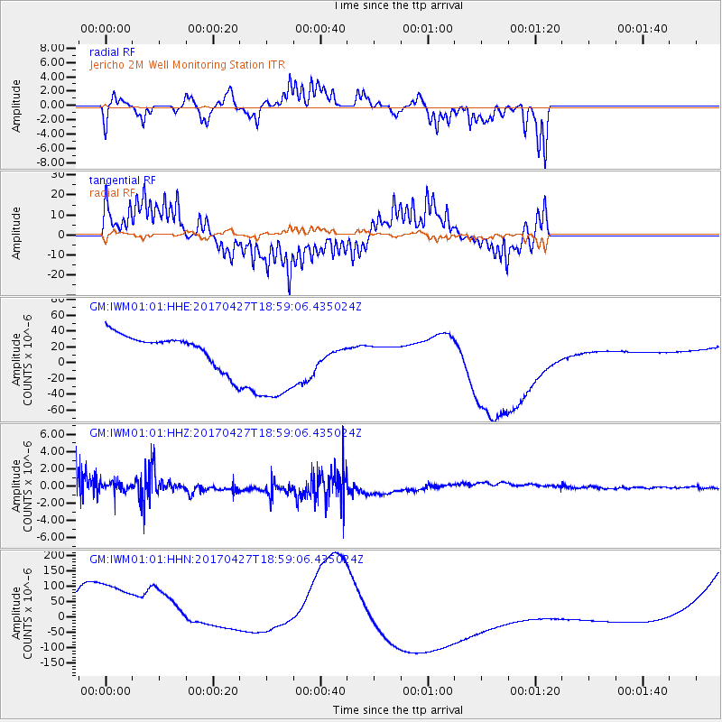
IWM01 Jericho 2M Well Monitoring Station - Earthquake Result Viewer
*The percent match for this event was below the threshold and hence no stack was calculated.
| Earthquake location: |
Tonga Islands |
| Earthquake latitude/longitude: |
-16.5/-173.7 |
| Earthquake time(UTC): |
2017/04/27 (117) 18:46:42 GMT |
| Earthquake Depth: |
33 km |
| Earthquake Magnitude: |
5.5 mb |
| Earthquake Catalog/Contributor: |
NEIC PDE/us |
|
| Network: |
GM US Geological Survey Networks |
| Station: |
IWM01 Jericho 2M Well Monitoring Station |
| Lat/Lon: |
36.73 N/96.53 W |
| Elevation: |
328 m |
|
| Distance: |
89.8 deg |
| Az: |
51.56 deg |
| Baz: |
249.265 deg |
| Ray Param: |
$rayparam |
*The percent match for this event was below the threshold and hence was not used in the summary stack. |
|
| Radial Match: |
28.789223 % |
| Radial Bump: |
186 |
| Transverse Match: |
57.896507 % |
| Transverse Bump: |
334 |
| SOD ConfigId: |
11737051 |
| Insert Time: |
2019-04-27 05:19:49.732 +0000 |
| GWidth: |
2.5 |
| Max Bumps: |
400 |
| Tol: |
0.001 |
|
Signal To Noise
| Channel | StoN | STA | LTA |
| GM:IWM01:01:HHZ:20170427T18:59:06.435024Z | 0.41664696 | 5.719459E-7 | 1.3727351E-6 |
| GM:IWM01:01:HHN:20170427T18:59:06.435024Z | 2.8133922 | 2.410967E-4 | 8.569608E-5 |
| GM:IWM01:01:HHE:20170427T18:59:06.435024Z | 3.0085146 | 5.936879E-5 | 1.9733588E-5 |
| Arrivals |
| Ps | |
| PpPs | |
| PsPs/PpSs | |


