You are here: Home > Network List > TA - USArray Transportable Network (new EarthScope stations) Stations List
> Station P17K Kvichak River, AK, USA > Earthquake Result Viewer
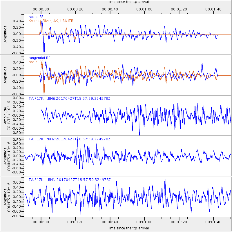
P17K Kvichak River, AK, USA - Earthquake Result Viewer
*The percent match for this event was below the threshold and hence no stack was calculated.
| Earthquake location: |
Tonga Islands |
| Earthquake latitude/longitude: |
-16.5/-173.7 |
| Earthquake time(UTC): |
2017/04/27 (117) 18:46:42 GMT |
| Earthquake Depth: |
33 km |
| Earthquake Magnitude: |
5.5 mb |
| Earthquake Catalog/Contributor: |
NEIC PDE/us |
|
| Network: |
TA USArray Transportable Network (new EarthScope stations) |
| Station: |
P17K Kvichak River, AK, USA |
| Lat/Lon: |
59.20 N/156.44 W |
| Elevation: |
91 m |
|
| Distance: |
76.7 deg |
| Az: |
9.011 deg |
| Baz: |
196.975 deg |
| Ray Param: |
$rayparam |
*The percent match for this event was below the threshold and hence was not used in the summary stack. |
|
| Radial Match: |
58.61971 % |
| Radial Bump: |
400 |
| Transverse Match: |
56.96978 % |
| Transverse Bump: |
400 |
| SOD ConfigId: |
11737051 |
| Insert Time: |
2019-04-27 05:23:13.655 +0000 |
| GWidth: |
2.5 |
| Max Bumps: |
400 |
| Tol: |
0.001 |
|
Signal To Noise
| Channel | StoN | STA | LTA |
| TA:P17K: :BHZ:20170427T18:57:59.324978Z | 2.020725 | 2.0804373E-7 | 1.0295499E-7 |
| TA:P17K: :BHN:20170427T18:57:59.324978Z | 1.6880821 | 2.4847955E-7 | 1.4719636E-7 |
| TA:P17K: :BHE:20170427T18:57:59.324978Z | 1.2247647 | 1.8080168E-7 | 1.4762156E-7 |
| Arrivals |
| Ps | |
| PpPs | |
| PsPs/PpSs | |


