You are here: Home > Network List > CI - Caltech Regional Seismic Network Stations List
> Station MPM Manuel Prospect Mine, California, USA > Earthquake Result Viewer
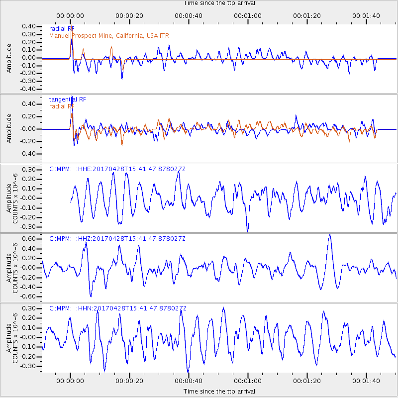
MPM Manuel Prospect Mine, California, USA - Earthquake Result Viewer
*The percent match for this event was below the threshold and hence no stack was calculated.
| Earthquake location: |
Near Coast Of Central Chile |
| Earthquake latitude/longitude: |
-33.2/-72.0 |
| Earthquake time(UTC): |
2017/04/28 (118) 15:30:05 GMT |
| Earthquake Depth: |
20 km |
| Earthquake Magnitude: |
5.9 Mww |
| Earthquake Catalog/Contributor: |
NEIC PDE/us |
|
| Network: |
CI Caltech Regional Seismic Network |
| Station: |
MPM Manuel Prospect Mine, California, USA |
| Lat/Lon: |
36.06 N/117.49 W |
| Elevation: |
185 m |
|
| Distance: |
81.0 deg |
| Az: |
324.193 deg |
| Baz: |
142.767 deg |
| Ray Param: |
$rayparam |
*The percent match for this event was below the threshold and hence was not used in the summary stack. |
|
| Radial Match: |
47.287712 % |
| Radial Bump: |
400 |
| Transverse Match: |
65.964645 % |
| Transverse Bump: |
400 |
| SOD ConfigId: |
11737051 |
| Insert Time: |
2019-04-27 05:27:33.488 +0000 |
| GWidth: |
2.5 |
| Max Bumps: |
400 |
| Tol: |
0.001 |
|
Signal To Noise
| Channel | StoN | STA | LTA |
| CI:MPM: :HHZ:20170428T15:41:47.878027Z | 1.7546504 | 1.6808583E-7 | 9.579449E-8 |
| CI:MPM: :HHN:20170428T15:41:47.878027Z | 1.3775942 | 9.6871474E-8 | 7.031931E-8 |
| CI:MPM: :HHE:20170428T15:41:47.878027Z | 0.4708628 | 7.081816E-8 | 1.5040084E-7 |
| Arrivals |
| Ps | |
| PpPs | |
| PsPs/PpSs | |


