You are here: Home > Network List > IW - Intermountain West Stations List
> Station MOOW Moose Ponds, Wyoming, USA > Earthquake Result Viewer
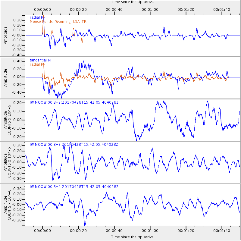
MOOW Moose Ponds, Wyoming, USA - Earthquake Result Viewer
*The percent match for this event was below the threshold and hence no stack was calculated.
| Earthquake location: |
Near Coast Of Central Chile |
| Earthquake latitude/longitude: |
-33.2/-72.0 |
| Earthquake time(UTC): |
2017/04/28 (118) 15:30:05 GMT |
| Earthquake Depth: |
20 km |
| Earthquake Magnitude: |
5.9 Mww |
| Earthquake Catalog/Contributor: |
NEIC PDE/us |
|
| Network: |
IW Intermountain West |
| Station: |
MOOW Moose Ponds, Wyoming, USA |
| Lat/Lon: |
43.75 N/110.74 W |
| Elevation: |
2128 m |
|
| Distance: |
84.4 deg |
| Az: |
332.886 deg |
| Baz: |
148.196 deg |
| Ray Param: |
$rayparam |
*The percent match for this event was below the threshold and hence was not used in the summary stack. |
|
| Radial Match: |
69.35163 % |
| Radial Bump: |
369 |
| Transverse Match: |
79.96739 % |
| Transverse Bump: |
400 |
| SOD ConfigId: |
11737051 |
| Insert Time: |
2019-04-27 05:29:23.366 +0000 |
| GWidth: |
2.5 |
| Max Bumps: |
400 |
| Tol: |
0.001 |
|
Signal To Noise
| Channel | StoN | STA | LTA |
| IW:MOOW:00:BHZ:20170428T15:42:05.404028Z | 1.3441529 | 1.3469227E-7 | 1.00206066E-7 |
| IW:MOOW:00:BH1:20170428T15:42:05.404028Z | 0.7802985 | 4.9046545E-8 | 6.285613E-8 |
| IW:MOOW:00:BH2:20170428T15:42:05.404028Z | 1.3093569 | 7.657503E-8 | 5.848293E-8 |
| Arrivals |
| Ps | |
| PpPs | |
| PsPs/PpSs | |


