You are here: Home > Network List > TA - USArray Transportable Network (new EarthScope stations) Stations List
> Station W13A Hualapai Mountain Park, Kingman, AZ, USA > Earthquake Result Viewer
W13A Hualapai Mountain Park, Kingman, AZ, USA - Earthquake Result Viewer

| Earthquake location: |
Tonga Islands |
| Earthquake latitude/longitude: |
-19.8/-174.7 |
| Earthquake time(UTC): |
2006/05/05 (125) 06:16:20 GMT |
| Earthquake Depth: |
35 km |
| Earthquake Magnitude: |
5.6 MB, 5.8 MS, 5.9 MW, 5.8 MW |
| Earthquake Catalog/Contributor: |
WHDF/NEIC |
|
| Network: |
TA USArray Transportable Network (new EarthScope stations) |
| Station: |
W13A Hualapai Mountain Park, Kingman, AZ, USA |
| Lat/Lon: |
35.10 N/113.89 W |
| Elevation: |
1988 m |
|
| Distance: |
79.4 deg |
| Az: |
46.715 deg |
| Baz: |
236.696 deg |
| Ray Param: |
0.048936415 |
| Estimated Moho Depth: |
69.5 km |
| Estimated Crust Vp/Vs: |
1.60 |
| Assumed Crust Vp: |
6.276 km/s |
| Estimated Crust Vs: |
3.916 km/s |
| Estimated Crust Poisson's Ratio: |
0.18 |
|
| Radial Match: |
81.77927 % |
| Radial Bump: |
400 |
| Transverse Match: |
55.95981 % |
| Transverse Bump: |
345 |
| SOD ConfigId: |
5423 |
| Insert Time: |
2010-03-05 23:22:23.491 +0000 |
| GWidth: |
2.5 |
| Max Bumps: |
400 |
| Tol: |
0.001 |
|
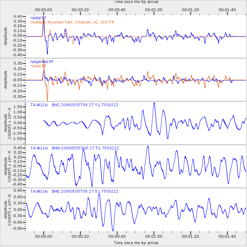
Signal To Noise
| Channel | StoN | STA | LTA |
| TA:W13A: :BHN:20060505T06:27:51.750022Z | 1.378869 | 1.9684522E-7 | 1.4275845E-7 |
| TA:W13A: :BHE:20060505T06:27:51.750022Z | 1.1393583 | 1.916052E-7 | 1.681694E-7 |
| TA:W13A: :BHZ:20060505T06:27:51.750022Z | 2.9439473 | 4.9723536E-7 | 1.6890091E-7 |
| Arrivals |
| Ps | 6.9 SECOND |
| PpPs | 28 SECOND |
| PsPs/PpSs | 35 SECOND |


