You are here: Home > Network List > TA - USArray Transportable Network (new EarthScope stations) Stations List
> Station W13A Hualapai Mountain Park, Kingman, AZ, USA > Earthquake Result Viewer
W13A Hualapai Mountain Park, Kingman, AZ, USA - Earthquake Result Viewer

| Earthquake location: |
Kuril Islands |
| Earthquake latitude/longitude: |
49.8/156.4 |
| Earthquake time(UTC): |
2006/08/20 (232) 03:01:02 GMT |
| Earthquake Depth: |
26 km |
| Earthquake Magnitude: |
5.8 MB, 5.7 MS, 6.0 MW, 5.9 MW |
| Earthquake Catalog/Contributor: |
WHDF/NEIC |
|
| Network: |
TA USArray Transportable Network (new EarthScope stations) |
| Station: |
W13A Hualapai Mountain Park, Kingman, AZ, USA |
| Lat/Lon: |
35.10 N/113.89 W |
| Elevation: |
1988 m |
|
| Distance: |
64.0 deg |
| Az: |
65.861 deg |
| Baz: |
313.879 deg |
| Ray Param: |
0.059194062 |
| Estimated Moho Depth: |
30.0 km |
| Estimated Crust Vp/Vs: |
1.66 |
| Assumed Crust Vp: |
6.276 km/s |
| Estimated Crust Vs: |
3.786 km/s |
| Estimated Crust Poisson's Ratio: |
0.21 |
|
| Radial Match: |
85.78483 % |
| Radial Bump: |
400 |
| Transverse Match: |
58.151104 % |
| Transverse Bump: |
400 |
| SOD ConfigId: |
2665 |
| Insert Time: |
2010-03-05 23:22:47.717 +0000 |
| GWidth: |
2.5 |
| Max Bumps: |
400 |
| Tol: |
0.001 |
|
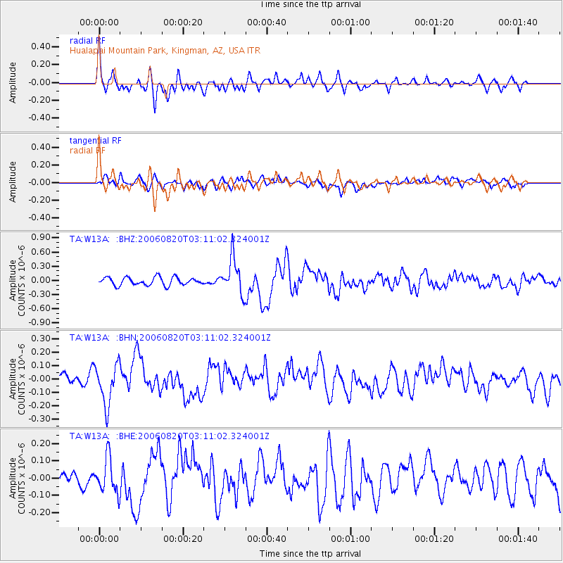
Signal To Noise
| Channel | StoN | STA | LTA |
| TA:W13A: :BHN:20060820T03:11:02.324001Z | 2.8737772 | 1.5217788E-7 | 5.295396E-8 |
| TA:W13A: :BHE:20060820T03:11:02.324001Z | 1.767129 | 1.0387009E-7 | 5.8779012E-8 |
| TA:W13A: :BHZ:20060820T03:11:02.324001Z | 4.668334 | 3.9182805E-7 | 8.3933166E-8 |
| Arrivals |
| Ps | 3.3 SECOND |
| PpPs | 12 SECOND |
| PsPs/PpSs | 15 SECOND |


