You are here: Home > Network List > TA - USArray Transportable Network (new EarthScope stations) Stations List
> Station N23A Red Feather Lakes, CO, USA > Earthquake Result Viewer
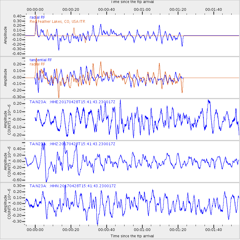
N23A Red Feather Lakes, CO, USA - Earthquake Result Viewer
*The percent match for this event was below the threshold and hence no stack was calculated.
| Earthquake location: |
Near Coast Of Central Chile |
| Earthquake latitude/longitude: |
-33.2/-72.0 |
| Earthquake time(UTC): |
2017/04/28 (118) 15:30:05 GMT |
| Earthquake Depth: |
20 km |
| Earthquake Magnitude: |
5.9 Mww |
| Earthquake Catalog/Contributor: |
NEIC PDE/us |
|
| Network: |
TA USArray Transportable Network (new EarthScope stations) |
| Station: |
N23A Red Feather Lakes, CO, USA |
| Lat/Lon: |
40.89 N/105.94 W |
| Elevation: |
2458 m |
|
| Distance: |
80.1 deg |
| Az: |
334.553 deg |
| Baz: |
151.643 deg |
| Ray Param: |
$rayparam |
*The percent match for this event was below the threshold and hence was not used in the summary stack. |
|
| Radial Match: |
60.315323 % |
| Radial Bump: |
400 |
| Transverse Match: |
54.012524 % |
| Transverse Bump: |
400 |
| SOD ConfigId: |
11737051 |
| Insert Time: |
2019-04-27 05:34:06.103 +0000 |
| GWidth: |
2.5 |
| Max Bumps: |
400 |
| Tol: |
0.001 |
|
Signal To Noise
| Channel | StoN | STA | LTA |
| TA:N23A: :HHZ:20170428T15:41:43.230017Z | 2.885318 | 2.7052394E-7 | 9.37588E-8 |
| TA:N23A: :HHN:20170428T15:41:43.230017Z | 1.0811503 | 8.5562974E-8 | 7.914068E-8 |
| TA:N23A: :HHE:20170428T15:41:43.230017Z | 0.9552027 | 8.509559E-8 | 8.908643E-8 |
| Arrivals |
| Ps | |
| PpPs | |
| PsPs/PpSs | |


