You are here: Home > Network List > TA - USArray Transportable Network (new EarthScope stations) Stations List
> Station Q24A Divide, CO, USA > Earthquake Result Viewer
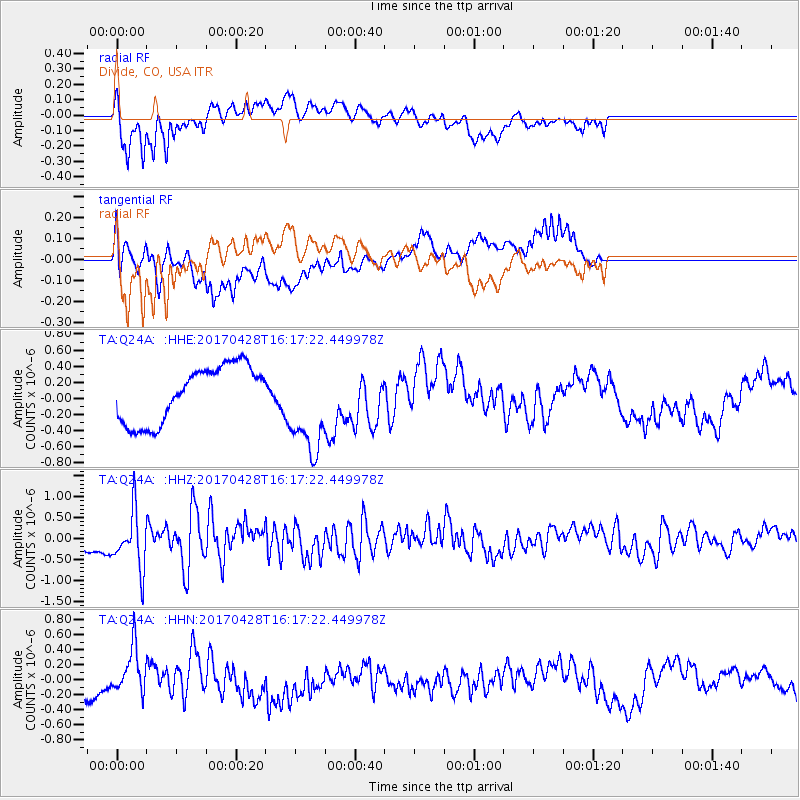
Q24A Divide, CO, USA - Earthquake Result Viewer
*The percent match for this event was below the threshold and hence no stack was calculated.
| Earthquake location: |
Near Coast Of Central Chile |
| Earthquake latitude/longitude: |
-33.1/-71.8 |
| Earthquake time(UTC): |
2017/04/28 (118) 16:05:55 GMT |
| Earthquake Depth: |
14 km |
| Earthquake Magnitude: |
5.7 Mww |
| Earthquake Catalog/Contributor: |
NEIC PDE/us |
|
| Network: |
TA USArray Transportable Network (new EarthScope stations) |
| Station: |
Q24A Divide, CO, USA |
| Lat/Lon: |
38.96 N/105.15 W |
| Elevation: |
2775 m |
|
| Distance: |
78.1 deg |
| Az: |
334.043 deg |
| Baz: |
151.891 deg |
| Ray Param: |
$rayparam |
*The percent match for this event was below the threshold and hence was not used in the summary stack. |
|
| Radial Match: |
75.354324 % |
| Radial Bump: |
400 |
| Transverse Match: |
48.285553 % |
| Transverse Bump: |
400 |
| SOD ConfigId: |
11737051 |
| Insert Time: |
2019-04-27 05:51:57.344 +0000 |
| GWidth: |
2.5 |
| Max Bumps: |
400 |
| Tol: |
0.001 |
|
Signal To Noise
| Channel | StoN | STA | LTA |
| TA:Q24A: :HHZ:20170428T16:17:22.449978Z | 4.2115455 | 6.844433E-7 | 1.6251596E-7 |
| TA:Q24A: :HHN:20170428T16:17:22.449978Z | 1.5331357 | 3.082676E-7 | 2.0107001E-7 |
| TA:Q24A: :HHE:20170428T16:17:22.449978Z | 1.7110611 | 5.957173E-7 | 3.4815668E-7 |
| Arrivals |
| Ps | |
| PpPs | |
| PsPs/PpSs | |


