You are here: Home > Network List > G - GEOSCOPE Stations List
> Station TAOE Taiohae, Marquises islands > Earthquake Result Viewer
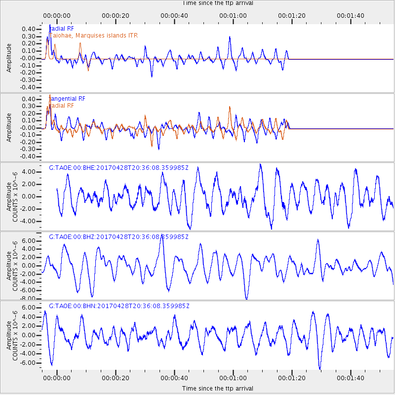
TAOE Taiohae, Marquises islands - Earthquake Result Viewer
*The percent match for this event was below the threshold and hence no stack was calculated.
| Earthquake location: |
Mindanao, Philippines |
| Earthquake latitude/longitude: |
5.5/125.1 |
| Earthquake time(UTC): |
2017/04/28 (118) 20:23:18 GMT |
| Earthquake Depth: |
10 km |
| Earthquake Magnitude: |
7.2 Mi |
| Earthquake Catalog/Contributor: |
NEIC PDE/pt |
|
| Network: |
G GEOSCOPE |
| Station: |
TAOE Taiohae, Marquises islands |
| Lat/Lon: |
8.85 S/140.15 W |
| Elevation: |
800 m |
|
| Distance: |
95.6 deg |
| Az: |
98.342 deg |
| Baz: |
274.667 deg |
| Ray Param: |
$rayparam |
*The percent match for this event was below the threshold and hence was not used in the summary stack. |
|
| Radial Match: |
55.206314 % |
| Radial Bump: |
365 |
| Transverse Match: |
52.795937 % |
| Transverse Bump: |
400 |
| SOD ConfigId: |
11737051 |
| Insert Time: |
2019-04-27 05:57:38.577 +0000 |
| GWidth: |
2.5 |
| Max Bumps: |
400 |
| Tol: |
0.001 |
|
Signal To Noise
| Channel | StoN | STA | LTA |
| G:TAOE:00:BHZ:20170428T20:36:08.359985Z | 1.856698 | 2.9763944E-6 | 1.6030579E-6 |
| G:TAOE:00:BHN:20170428T20:36:08.359985Z | 1.3564337 | 2.0617776E-6 | 1.5199989E-6 |
| G:TAOE:00:BHE:20170428T20:36:08.359985Z | 1.4973553 | 2.0202808E-6 | 1.3492328E-6 |
| Arrivals |
| Ps | |
| PpPs | |
| PsPs/PpSs | |


