You are here: Home > Network List > TA - USArray Transportable Network (new EarthScope stations) Stations List
> Station Q17K Contact Creek, Katmai, AK, USA > Earthquake Result Viewer
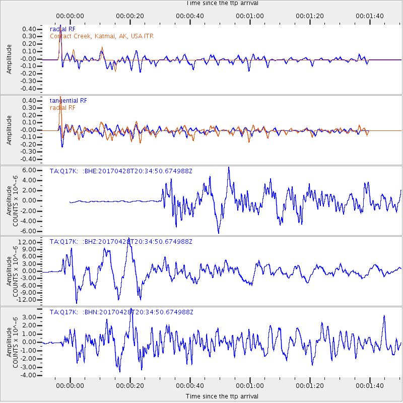
Q17K Contact Creek, Katmai, AK, USA - Earthquake Result Viewer
*The percent match for this event was below the threshold and hence no stack was calculated.
| Earthquake location: |
Mindanao, Philippines |
| Earthquake latitude/longitude: |
5.5/125.1 |
| Earthquake time(UTC): |
2017/04/28 (118) 20:23:18 GMT |
| Earthquake Depth: |
10 km |
| Earthquake Magnitude: |
7.2 Mi |
| Earthquake Catalog/Contributor: |
NEIC PDE/pt |
|
| Network: |
TA USArray Transportable Network (new EarthScope stations) |
| Station: |
Q17K Contact Creek, Katmai, AK, USA |
| Lat/Lon: |
58.26 N/155.89 W |
| Elevation: |
1165 m |
|
| Distance: |
79.6 deg |
| Az: |
31.844 deg |
| Baz: |
263.561 deg |
| Ray Param: |
$rayparam |
*The percent match for this event was below the threshold and hence was not used in the summary stack. |
|
| Radial Match: |
92.359566 % |
| Radial Bump: |
400 |
| Transverse Match: |
86.047485 % |
| Transverse Bump: |
400 |
| SOD ConfigId: |
11737051 |
| Insert Time: |
2019-04-27 06:00:40.130 +0000 |
| GWidth: |
2.5 |
| Max Bumps: |
400 |
| Tol: |
0.001 |
|
Signal To Noise
| Channel | StoN | STA | LTA |
| TA:Q17K: :BHZ:20170428T20:34:50.674988Z | 39.481438 | 6.347233E-6 | 1.60765E-7 |
| TA:Q17K: :BHN:20170428T20:34:50.674988Z | 17.710608 | 1.2385958E-6 | 6.9935254E-8 |
| TA:Q17K: :BHE:20170428T20:34:50.674988Z | 29.465181 | 2.2634115E-6 | 7.681648E-8 |
| Arrivals |
| Ps | |
| PpPs | |
| PsPs/PpSs | |


