You are here: Home > Network List > TA - USArray Transportable Network (new EarthScope stations) Stations List
> Station R17K Ugashik Creek, AK, USA > Earthquake Result Viewer
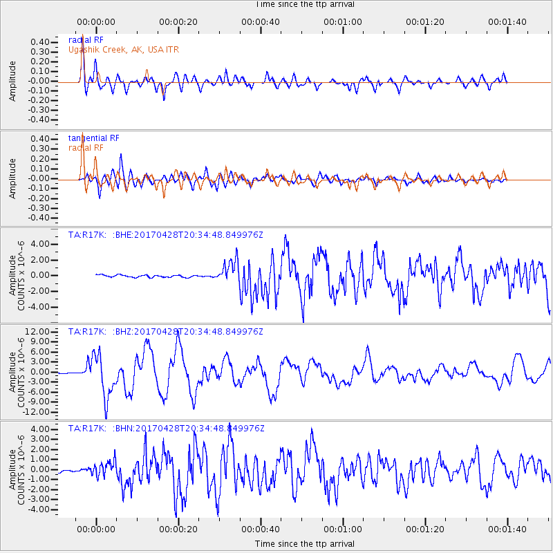
R17K Ugashik Creek, AK, USA - Earthquake Result Viewer
*The percent match for this event was below the threshold and hence no stack was calculated.
| Earthquake location: |
Mindanao, Philippines |
| Earthquake latitude/longitude: |
5.5/125.1 |
| Earthquake time(UTC): |
2017/04/28 (118) 20:23:18 GMT |
| Earthquake Depth: |
10 km |
| Earthquake Magnitude: |
7.2 Mi |
| Earthquake Catalog/Contributor: |
NEIC PDE/pt |
|
| Network: |
TA USArray Transportable Network (new EarthScope stations) |
| Station: |
R17K Ugashik Creek, AK, USA |
| Lat/Lon: |
57.64 N/156.39 W |
| Elevation: |
273 m |
|
| Distance: |
79.3 deg |
| Az: |
32.445 deg |
| Baz: |
263.248 deg |
| Ray Param: |
$rayparam |
*The percent match for this event was below the threshold and hence was not used in the summary stack. |
|
| Radial Match: |
85.13293 % |
| Radial Bump: |
400 |
| Transverse Match: |
88.56835 % |
| Transverse Bump: |
400 |
| SOD ConfigId: |
11737051 |
| Insert Time: |
2019-04-27 06:00:45.018 +0000 |
| GWidth: |
2.5 |
| Max Bumps: |
400 |
| Tol: |
0.001 |
|
Signal To Noise
| Channel | StoN | STA | LTA |
| TA:R17K: :BHZ:20170428T20:34:48.849976Z | 44.453636 | 6.5020376E-6 | 1.462656E-7 |
| TA:R17K: :BHN:20170428T20:34:48.849976Z | 6.039772 | 7.1657786E-7 | 1.1864319E-7 |
| TA:R17K: :BHE:20170428T20:34:48.849976Z | 18.27299 | 2.2980607E-6 | 1.2576272E-7 |
| Arrivals |
| Ps | |
| PpPs | |
| PsPs/PpSs | |


