You are here: Home > Network List > CN - Canadian National Seismograph Network Stations List
> Station INK INUVIK, NT > Earthquake Result Viewer
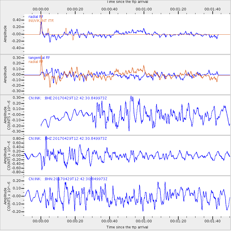
INK INUVIK, NT - Earthquake Result Viewer
*The percent match for this event was below the threshold and hence no stack was calculated.
| Earthquake location: |
Kyushu, Japan |
| Earthquake latitude/longitude: |
30.8/131.4 |
| Earthquake time(UTC): |
2017/04/29 (119) 12:32:32 GMT |
| Earthquake Depth: |
21 km |
| Earthquake Magnitude: |
5.7 Mww |
| Earthquake Catalog/Contributor: |
NEIC PDE/us |
|
| Network: |
CN Canadian National Seismograph Network |
| Station: |
INK INUVIK, NT |
| Lat/Lon: |
68.31 N/133.53 W |
| Elevation: |
44 m |
|
| Distance: |
63.6 deg |
| Az: |
24.429 deg |
| Baz: |
286.861 deg |
| Ray Param: |
$rayparam |
*The percent match for this event was below the threshold and hence was not used in the summary stack. |
|
| Radial Match: |
70.9043 % |
| Radial Bump: |
400 |
| Transverse Match: |
53.090122 % |
| Transverse Bump: |
400 |
| SOD ConfigId: |
11737051 |
| Insert Time: |
2019-04-27 06:09:14.675 +0000 |
| GWidth: |
2.5 |
| Max Bumps: |
400 |
| Tol: |
0.001 |
|
Signal To Noise
| Channel | StoN | STA | LTA |
| CN:INK: :BHZ:20170429T12:42:30.849973Z | 4.5764174 | 3.9539387E-7 | 8.639812E-8 |
| CN:INK: :BHN:20170429T12:42:30.849973Z | 1.1316937 | 6.263078E-8 | 5.5342518E-8 |
| CN:INK: :BHE:20170429T12:42:30.849973Z | 1.6841637 | 1.278711E-7 | 7.592558E-8 |
| Arrivals |
| Ps | |
| PpPs | |
| PsPs/PpSs | |


