You are here: Home > Network List > TA - USArray Transportable Network (new EarthScope stations) Stations List
> Station D23K Nanushuk River, AK USA > Earthquake Result Viewer
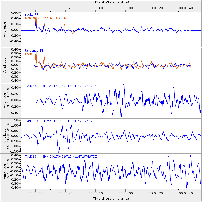
D23K Nanushuk River, AK USA - Earthquake Result Viewer
*The percent match for this event was below the threshold and hence no stack was calculated.
| Earthquake location: |
Kyushu, Japan |
| Earthquake latitude/longitude: |
30.8/131.4 |
| Earthquake time(UTC): |
2017/04/29 (119) 12:32:32 GMT |
| Earthquake Depth: |
21 km |
| Earthquake Magnitude: |
5.7 Mww |
| Earthquake Catalog/Contributor: |
NEIC PDE/us |
|
| Network: |
TA USArray Transportable Network (new EarthScope stations) |
| Station: |
D23K Nanushuk River, AK USA |
| Lat/Lon: |
68.97 N/150.68 W |
| Elevation: |
406 m |
|
| Distance: |
57.3 deg |
| Az: |
24.807 deg |
| Baz: |
271.07 deg |
| Ray Param: |
$rayparam |
*The percent match for this event was below the threshold and hence was not used in the summary stack. |
|
| Radial Match: |
77.74056 % |
| Radial Bump: |
400 |
| Transverse Match: |
78.05196 % |
| Transverse Bump: |
400 |
| SOD ConfigId: |
11737051 |
| Insert Time: |
2019-04-27 06:13:46.461 +0000 |
| GWidth: |
2.5 |
| Max Bumps: |
400 |
| Tol: |
0.001 |
|
Signal To Noise
| Channel | StoN | STA | LTA |
| TA:D23K: :BHZ:20170429T12:41:47.974973Z | 3.5974631 | 5.320108E-7 | 1.4788499E-7 |
| TA:D23K: :BHN:20170429T12:41:47.974973Z | 0.73190093 | 7.376232E-8 | 1.0078185E-7 |
| TA:D23K: :BHE:20170429T12:41:47.974973Z | 1.4718435 | 1.4210697E-7 | 9.655032E-8 |
| Arrivals |
| Ps | |
| PpPs | |
| PsPs/PpSs | |


