You are here: Home > Network List > TA - USArray Transportable Network (new EarthScope stations) Stations List
> Station R32K Eaglecrest, AK, USA > Earthquake Result Viewer
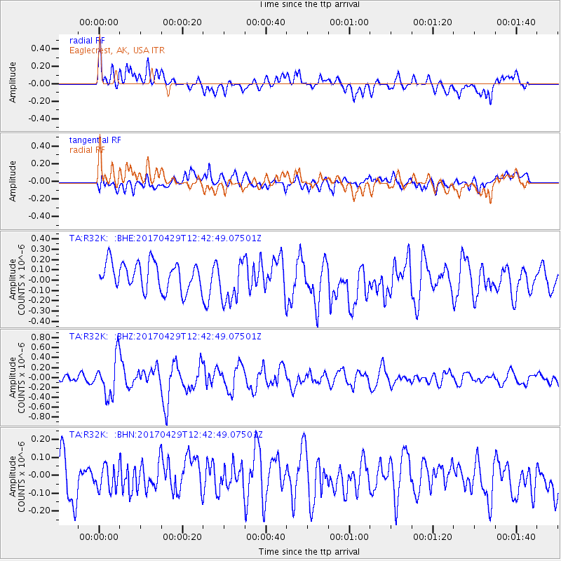
R32K Eaglecrest, AK, USA - Earthquake Result Viewer
*The percent match for this event was below the threshold and hence no stack was calculated.
| Earthquake location: |
Kyushu, Japan |
| Earthquake latitude/longitude: |
30.8/131.4 |
| Earthquake time(UTC): |
2017/04/29 (119) 12:32:32 GMT |
| Earthquake Depth: |
21 km |
| Earthquake Magnitude: |
5.7 Mww |
| Earthquake Catalog/Contributor: |
NEIC PDE/us |
|
| Network: |
TA USArray Transportable Network (new EarthScope stations) |
| Station: |
R32K Eaglecrest, AK, USA |
| Lat/Lon: |
58.27 N/134.52 W |
| Elevation: |
386 m |
|
| Distance: |
66.4 deg |
| Az: |
35.118 deg |
| Baz: |
290.505 deg |
| Ray Param: |
$rayparam |
*The percent match for this event was below the threshold and hence was not used in the summary stack. |
|
| Radial Match: |
53.37792 % |
| Radial Bump: |
400 |
| Transverse Match: |
45.6743 % |
| Transverse Bump: |
400 |
| SOD ConfigId: |
11737051 |
| Insert Time: |
2019-04-27 06:14:55.626 +0000 |
| GWidth: |
2.5 |
| Max Bumps: |
400 |
| Tol: |
0.001 |
|
Signal To Noise
| Channel | StoN | STA | LTA |
| TA:R32K: :BHZ:20170429T12:42:49.07501Z | 2.6210647 | 4.0244112E-7 | 1.5354108E-7 |
| TA:R32K: :BHN:20170429T12:42:49.07501Z | 0.5439354 | 8.866009E-8 | 1.6299747E-7 |
| TA:R32K: :BHE:20170429T12:42:49.07501Z | 1.613814 | 2.1216789E-7 | 1.3146986E-7 |
| Arrivals |
| Ps | |
| PpPs | |
| PsPs/PpSs | |


