You are here: Home > Network List > TA - USArray Transportable Network (new EarthScope stations) Stations List
> Station R33M Jennings River, BC, CAN > Earthquake Result Viewer
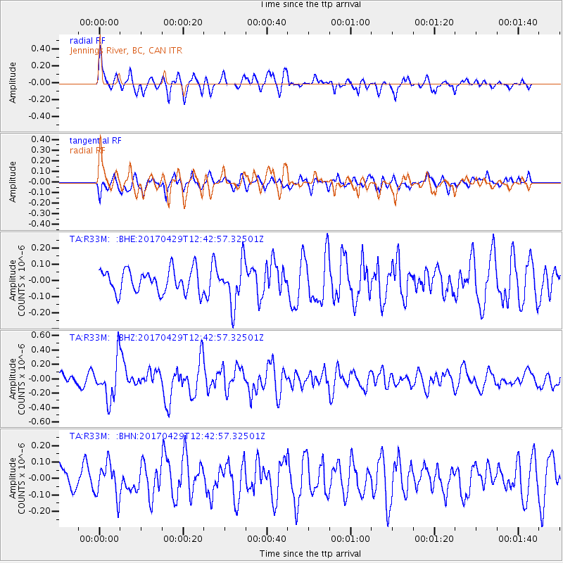
R33M Jennings River, BC, CAN - Earthquake Result Viewer
*The percent match for this event was below the threshold and hence no stack was calculated.
| Earthquake location: |
Kyushu, Japan |
| Earthquake latitude/longitude: |
30.8/131.4 |
| Earthquake time(UTC): |
2017/04/29 (119) 12:32:32 GMT |
| Earthquake Depth: |
21 km |
| Earthquake Magnitude: |
5.7 Mww |
| Earthquake Catalog/Contributor: |
NEIC PDE/us |
|
| Network: |
TA USArray Transportable Network (new EarthScope stations) |
| Station: |
R33M Jennings River, BC, CAN |
| Lat/Lon: |
59.39 N/130.97 W |
| Elevation: |
1437 m |
|
| Distance: |
67.7 deg |
| Az: |
33.244 deg |
| Baz: |
292.807 deg |
| Ray Param: |
$rayparam |
*The percent match for this event was below the threshold and hence was not used in the summary stack. |
|
| Radial Match: |
67.10664 % |
| Radial Bump: |
400 |
| Transverse Match: |
59.07027 % |
| Transverse Bump: |
400 |
| SOD ConfigId: |
11737051 |
| Insert Time: |
2019-04-27 06:14:55.970 +0000 |
| GWidth: |
2.5 |
| Max Bumps: |
400 |
| Tol: |
0.001 |
|
Signal To Noise
| Channel | StoN | STA | LTA |
| TA:R33M: :BHZ:20170429T12:42:57.32501Z | 4.834565 | 2.8883665E-7 | 5.974408E-8 |
| TA:R33M: :BHN:20170429T12:42:57.32501Z | 1.2862378 | 1.04296824E-7 | 8.108673E-8 |
| TA:R33M: :BHE:20170429T12:42:57.32501Z | 1.8557731 | 1.316944E-7 | 7.096472E-8 |
| Arrivals |
| Ps | |
| PpPs | |
| PsPs/PpSs | |


