You are here: Home > Network List > UW - Pacific Northwest Regional Seismic Network Stations List
> Station MRBL Marblemount, WA, USA > Earthquake Result Viewer
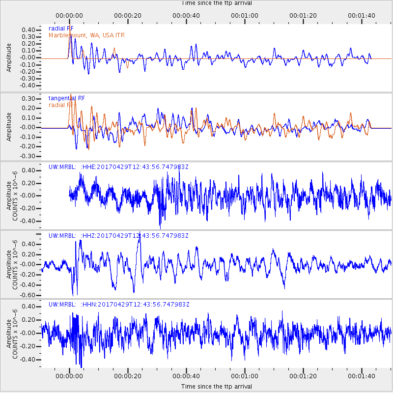
MRBL Marblemount, WA, USA - Earthquake Result Viewer
*The percent match for this event was below the threshold and hence no stack was calculated.
| Earthquake location: |
Kyushu, Japan |
| Earthquake latitude/longitude: |
30.8/131.4 |
| Earthquake time(UTC): |
2017/04/29 (119) 12:32:32 GMT |
| Earthquake Depth: |
21 km |
| Earthquake Magnitude: |
5.7 Mww |
| Earthquake Catalog/Contributor: |
NEIC PDE/us |
|
| Network: |
UW Pacific Northwest Regional Seismic Network |
| Station: |
MRBL Marblemount, WA, USA |
| Lat/Lon: |
48.52 N/121.48 W |
| Elevation: |
75 m |
|
| Distance: |
77.7 deg |
| Az: |
40.572 deg |
| Baz: |
302.688 deg |
| Ray Param: |
$rayparam |
*The percent match for this event was below the threshold and hence was not used in the summary stack. |
|
| Radial Match: |
58.92632 % |
| Radial Bump: |
400 |
| Transverse Match: |
53.46081 % |
| Transverse Bump: |
400 |
| SOD ConfigId: |
11737051 |
| Insert Time: |
2019-04-27 06:15:39.340 +0000 |
| GWidth: |
2.5 |
| Max Bumps: |
400 |
| Tol: |
0.001 |
|
Signal To Noise
| Channel | StoN | STA | LTA |
| UW:MRBL: :HHZ:20170429T12:43:56.747983Z | 3.177726 | 2.714744E-7 | 8.543039E-8 |
| UW:MRBL: :HHN:20170429T12:43:56.747983Z | 2.1169343 | 2.0191614E-7 | 9.5381395E-8 |
| UW:MRBL: :HHE:20170429T12:43:56.747983Z | 1.6795624 | 1.9771237E-7 | 1.1771659E-7 |
| Arrivals |
| Ps | |
| PpPs | |
| PsPs/PpSs | |


