You are here: Home > Network List > UW - Pacific Northwest Regional Seismic Network Stations List
> Station UMAT Pilot Rock, OR, USA > Earthquake Result Viewer
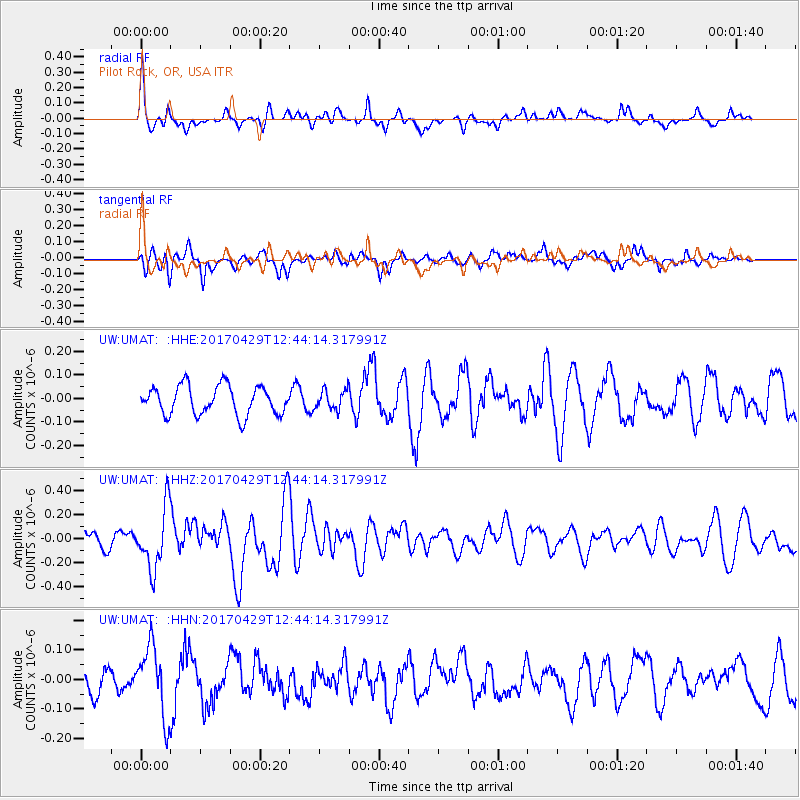
UMAT Pilot Rock, OR, USA - Earthquake Result Viewer
*The percent match for this event was below the threshold and hence no stack was calculated.
| Earthquake location: |
Kyushu, Japan |
| Earthquake latitude/longitude: |
30.8/131.4 |
| Earthquake time(UTC): |
2017/04/29 (119) 12:32:32 GMT |
| Earthquake Depth: |
21 km |
| Earthquake Magnitude: |
5.7 Mww |
| Earthquake Catalog/Contributor: |
NEIC PDE/us |
|
| Network: |
UW Pacific Northwest Regional Seismic Network |
| Station: |
UMAT Pilot Rock, OR, USA |
| Lat/Lon: |
45.29 N/118.96 W |
| Elevation: |
1318 m |
|
| Distance: |
81.0 deg |
| Az: |
42.324 deg |
| Baz: |
304.851 deg |
| Ray Param: |
$rayparam |
*The percent match for this event was below the threshold and hence was not used in the summary stack. |
|
| Radial Match: |
65.81687 % |
| Radial Bump: |
355 |
| Transverse Match: |
51.717937 % |
| Transverse Bump: |
359 |
| SOD ConfigId: |
11737051 |
| Insert Time: |
2019-04-27 06:15:42.585 +0000 |
| GWidth: |
2.5 |
| Max Bumps: |
400 |
| Tol: |
0.001 |
|
Signal To Noise
| Channel | StoN | STA | LTA |
| UW:UMAT: :HHZ:20170429T12:44:14.317991Z | 4.713334 | 2.561073E-7 | 5.4336763E-8 |
| UW:UMAT: :HHN:20170429T12:44:14.317991Z | 1.9880798 | 1.1947218E-7 | 6.009425E-8 |
| UW:UMAT: :HHE:20170429T12:44:14.317991Z | 0.64587194 | 3.968261E-8 | 6.144037E-8 |
| Arrivals |
| Ps | |
| PpPs | |
| PsPs/PpSs | |


