You are here: Home > Network List > TA - USArray Transportable Network (new EarthScope stations) Stations List
> Station 430A Baggett Ranch, Ozona, TX, USA > Earthquake Result Viewer
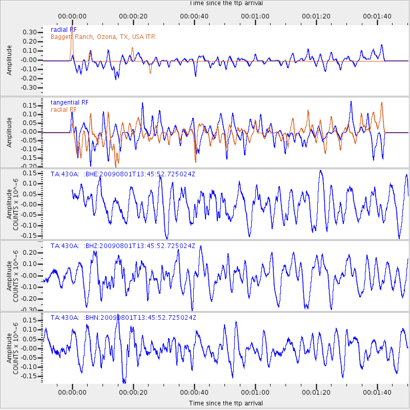
430A Baggett Ranch, Ozona, TX, USA - Earthquake Result Viewer
*The percent match for this event was below the threshold and hence no stack was calculated.
| Earthquake location: |
Southern East Pacific Rise |
| Earthquake latitude/longitude: |
-56.2/-124.3 |
| Earthquake time(UTC): |
2009/08/01 (213) 13:33:29 GMT |
| Earthquake Depth: |
10 km |
| Earthquake Magnitude: |
6.1 MW, 5.4 MS, 5.2 MB, 6.0 MW |
| Earthquake Catalog/Contributor: |
WHDF/NEIC |
|
| Network: |
TA USArray Transportable Network (new EarthScope stations) |
| Station: |
430A Baggett Ranch, Ozona, TX, USA |
| Lat/Lon: |
30.79 N/101.24 W |
| Elevation: |
768 m |
|
| Distance: |
88.9 deg |
| Az: |
19.703 deg |
| Baz: |
192.636 deg |
| Ray Param: |
$rayparam |
*The percent match for this event was below the threshold and hence was not used in the summary stack. |
|
| Radial Match: |
56.18124 % |
| Radial Bump: |
400 |
| Transverse Match: |
48.913605 % |
| Transverse Bump: |
400 |
| SOD ConfigId: |
2622 |
| Insert Time: |
2010-03-05 23:29:10.899 +0000 |
| GWidth: |
2.5 |
| Max Bumps: |
400 |
| Tol: |
0.001 |
|
Signal To Noise
| Channel | StoN | STA | LTA |
| TA:430A: :BHZ:20090801T13:45:52.725024Z | 1.7336274 | 1.1097597E-7 | 6.401374E-8 |
| TA:430A: :BHN:20090801T13:45:52.725024Z | 1.4804784 | 8.250661E-8 | 5.5729696E-8 |
| TA:430A: :BHE:20090801T13:45:52.725024Z | 1.7270879 | 9.2409756E-8 | 5.3506113E-8 |
| Arrivals |
| Ps | |
| PpPs | |
| PsPs/PpSs | |


