You are here: Home > Network List > TA - USArray Transportable Network (new EarthScope stations) Stations List
> Station 430A Baggett Ranch, Ozona, TX, USA > Earthquake Result Viewer
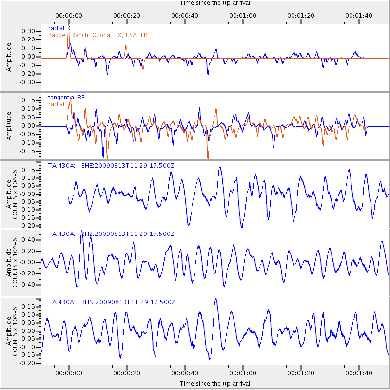
430A Baggett Ranch, Ozona, TX, USA - Earthquake Result Viewer
*The percent match for this event was below the threshold and hence no stack was calculated.
| Earthquake location: |
Tonga Islands |
| Earthquake latitude/longitude: |
-21.7/-174.6 |
| Earthquake time(UTC): |
2009/08/13 (225) 11:17:01 GMT |
| Earthquake Depth: |
10 km |
| Earthquake Magnitude: |
5.6 MW, 5.3 MB |
| Earthquake Catalog/Contributor: |
WHDF/NEIC |
|
| Network: |
TA USArray Transportable Network (new EarthScope stations) |
| Station: |
430A Baggett Ranch, Ozona, TX, USA |
| Lat/Lon: |
30.79 N/101.24 W |
| Elevation: |
768 m |
|
| Distance: |
87.6 deg |
| Az: |
55.605 deg |
| Baz: |
243.118 deg |
| Ray Param: |
$rayparam |
*The percent match for this event was below the threshold and hence was not used in the summary stack. |
|
| Radial Match: |
68.38734 % |
| Radial Bump: |
290 |
| Transverse Match: |
68.44228 % |
| Transverse Bump: |
314 |
| SOD ConfigId: |
2622 |
| Insert Time: |
2010-03-05 23:29:13.679 +0000 |
| GWidth: |
2.5 |
| Max Bumps: |
400 |
| Tol: |
0.001 |
|
Signal To Noise
| Channel | StoN | STA | LTA |
| TA:430A: :BHZ:20090813T11:29:17.500Z | 3.2114482 | 2.8285032E-7 | 8.807563E-8 |
| TA:430A: :BHN:20090813T11:29:17.500Z | 0.97209203 | 6.234868E-8 | 6.413866E-8 |
| TA:430A: :BHE:20090813T11:29:17.500Z | 1.47212 | 5.33841E-8 | 3.6263415E-8 |
| Arrivals |
| Ps | |
| PpPs | |
| PsPs/PpSs | |


