You are here: Home > Network List > TA - USArray Transportable Network (new EarthScope stations) Stations List
> Station 430A Baggett Ranch, Ozona, TX, USA > Earthquake Result Viewer
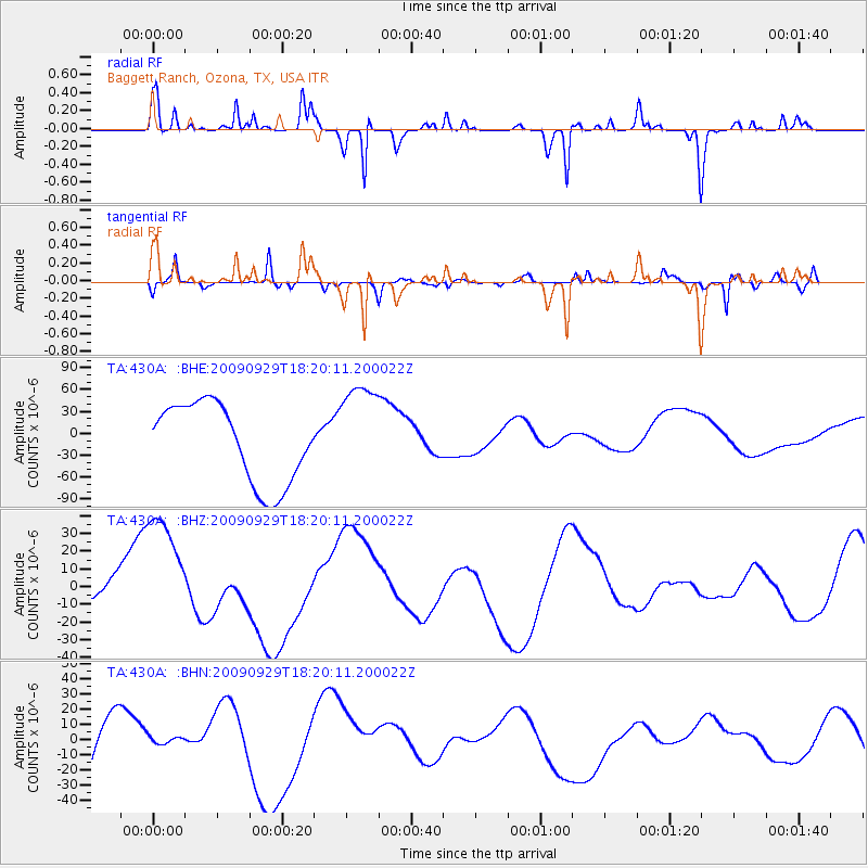
430A Baggett Ranch, Ozona, TX, USA - Earthquake Result Viewer
*The percent match for this event was below the threshold and hence no stack was calculated.
| Earthquake location: |
Samoa Islands Region |
| Earthquake latitude/longitude: |
-15.6/-172.0 |
| Earthquake time(UTC): |
2009/09/29 (272) 18:08:21 GMT |
| Earthquake Depth: |
10 km |
| Earthquake Magnitude: |
5.6 MB |
| Earthquake Catalog/Contributor: |
WHDF/NEIC |
|
| Network: |
TA USArray Transportable Network (new EarthScope stations) |
| Station: |
430A Baggett Ranch, Ozona, TX, USA |
| Lat/Lon: |
30.79 N/101.24 W |
| Elevation: |
768 m |
|
| Distance: |
82.1 deg |
| Az: |
55.123 deg |
| Baz: |
246.752 deg |
| Ray Param: |
$rayparam |
*The percent match for this event was below the threshold and hence was not used in the summary stack. |
|
| Radial Match: |
36.981583 % |
| Radial Bump: |
147 |
| Transverse Match: |
43.320538 % |
| Transverse Bump: |
251 |
| SOD ConfigId: |
2622 |
| Insert Time: |
2010-03-05 23:29:17.845 +0000 |
| GWidth: |
2.5 |
| Max Bumps: |
400 |
| Tol: |
0.001 |
|
Signal To Noise
| Channel | StoN | STA | LTA |
| TA:430A: :BHZ:20090929T18:20:11.200022Z | 3.4157107 | 4.076048E-5 | 1.1933235E-5 |
| TA:430A: :BHN:20090929T18:20:11.200022Z | 0.082848005 | 3.6076171E-6 | 4.3545006E-5 |
| TA:430A: :BHE:20090929T18:20:11.200022Z | 1.2546322 | 6.7862624E-5 | 5.408965E-5 |
| Arrivals |
| Ps | |
| PpPs | |
| PsPs/PpSs | |


