You are here: Home > Network List > TA - USArray Transportable Network (new EarthScope stations) Stations List
> Station MSTX Muleshoe, TX, USA > Earthquake Result Viewer
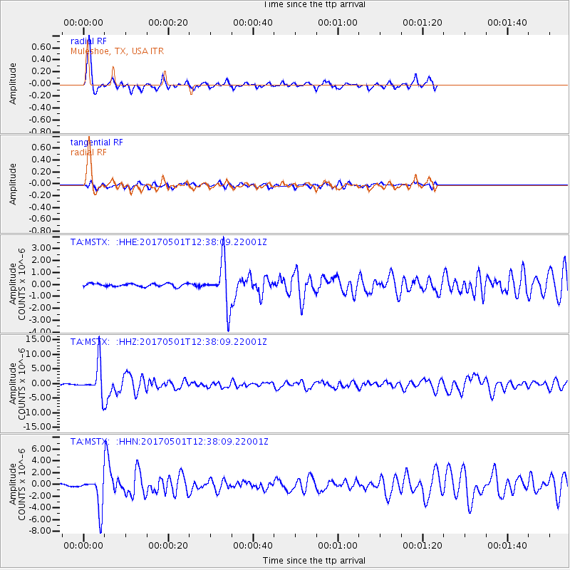
MSTX Muleshoe, TX, USA - Earthquake Result Viewer
*The percent match for this event was below the threshold and hence no stack was calculated.
| Earthquake location: |
Southeastern Alaska |
| Earthquake latitude/longitude: |
59.9/-136.6 |
| Earthquake time(UTC): |
2017/05/01 (121) 12:31:53 GMT |
| Earthquake Depth: |
0.1 km |
| Earthquake Magnitude: |
6.5 Ml |
| Earthquake Catalog/Contributor: |
NEIC PDE/ak |
|
| Network: |
TA USArray Transportable Network (new EarthScope stations) |
| Station: |
MSTX Muleshoe, TX, USA |
| Lat/Lon: |
33.97 N/102.77 W |
| Elevation: |
1167 m |
|
| Distance: |
34.0 deg |
| Az: |
124.335 deg |
| Baz: |
329.913 deg |
| Ray Param: |
$rayparam |
*The percent match for this event was below the threshold and hence was not used in the summary stack. |
|
| Radial Match: |
90.98412 % |
| Radial Bump: |
400 |
| Transverse Match: |
58.624836 % |
| Transverse Bump: |
400 |
| SOD ConfigId: |
11737051 |
| Insert Time: |
2019-04-27 06:26:56.111 +0000 |
| GWidth: |
2.5 |
| Max Bumps: |
400 |
| Tol: |
0.001 |
|
Signal To Noise
| Channel | StoN | STA | LTA |
| TA:MSTX: :HHZ:20170501T12:38:09.22001Z | 45.901184 | 5.7004813E-6 | 1.2419028E-7 |
| TA:MSTX: :HHN:20170501T12:38:09.22001Z | 13.668846 | 2.9066791E-6 | 2.1264994E-7 |
| TA:MSTX: :HHE:20170501T12:38:09.22001Z | 11.374248 | 1.419097E-6 | 1.2476403E-7 |
| Arrivals |
| Ps | |
| PpPs | |
| PsPs/PpSs | |


