You are here: Home > Network List > TA - USArray Transportable Network (new EarthScope stations) Stations List
> Station Z16A Peralta Trail, Apache Junction, AZ, USA > Earthquake Result Viewer
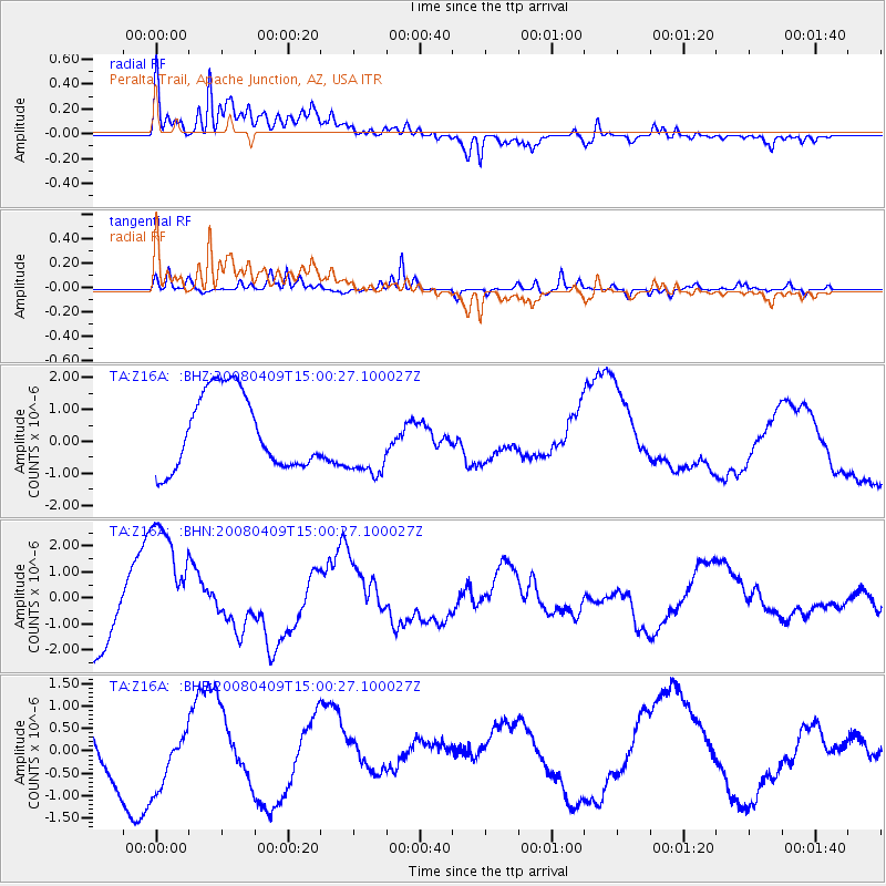
Z16A Peralta Trail, Apache Junction, AZ, USA - Earthquake Result Viewer
*The percent match for this event was below the threshold and hence no stack was calculated.
| Earthquake location: |
Vanuatu Islands |
| Earthquake latitude/longitude: |
-20.0/168.9 |
| Earthquake time(UTC): |
2008/04/09 (100) 14:47:50 GMT |
| Earthquake Depth: |
35 km |
| Earthquake Magnitude: |
5.9 MB, 6.2 MS, 6.3 MW |
| Earthquake Catalog/Contributor: |
WHDF/NEIC |
|
| Network: |
TA USArray Transportable Network (new EarthScope stations) |
| Station: |
Z16A Peralta Trail, Apache Junction, AZ, USA |
| Lat/Lon: |
33.34 N/111.43 W |
| Elevation: |
537 m |
|
| Distance: |
92.6 deg |
| Az: |
55.533 deg |
| Baz: |
247.855 deg |
| Ray Param: |
$rayparam |
*The percent match for this event was below the threshold and hence was not used in the summary stack. |
|
| Radial Match: |
77.85402 % |
| Radial Bump: |
400 |
| Transverse Match: |
80.45258 % |
| Transverse Bump: |
336 |
| SOD ConfigId: |
2504 |
| Insert Time: |
2010-03-05 23:32:01.106 +0000 |
| GWidth: |
2.5 |
| Max Bumps: |
400 |
| Tol: |
0.001 |
|
Signal To Noise
| Channel | StoN | STA | LTA |
| TA:Z16A: :BHN:20080409T15:00:27.100027Z | 1.811971 | 2.6382309E-6 | 1.4560006E-6 |
| TA:Z16A: :BHE:20080409T15:00:27.100027Z | 1.6915792 | 7.731458E-7 | 4.5705562E-7 |
| TA:Z16A: :BHZ:20080409T15:00:27.100027Z | 0.99869275 | 1.1651061E-6 | 1.1666313E-6 |
| Arrivals |
| Ps | |
| PpPs | |
| PsPs/PpSs | |


