You are here: Home > Network List > CI - Caltech Regional Seismic Network Stations List
> Station SWS Sam W. Stewart, Westmorland, CA, USA > Earthquake Result Viewer
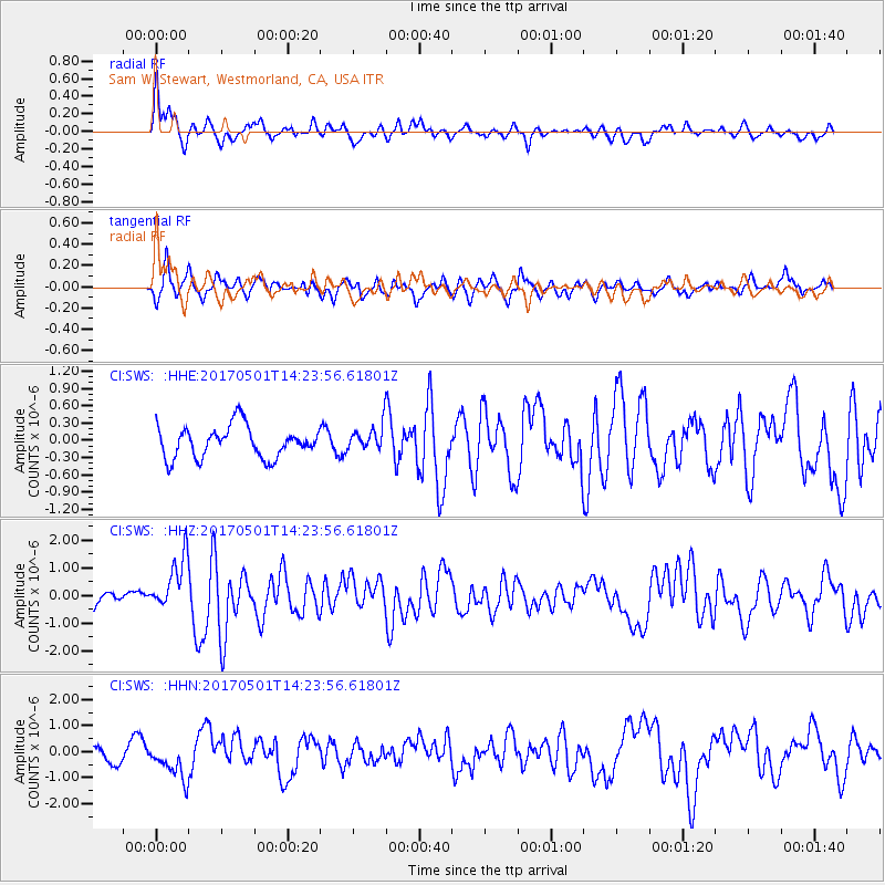
SWS Sam W. Stewart, Westmorland, CA, USA - Earthquake Result Viewer
*The percent match for this event was below the threshold and hence no stack was calculated.
| Earthquake location: |
Southeastern Alaska |
| Earthquake latitude/longitude: |
59.8/-136.6 |
| Earthquake time(UTC): |
2017/05/01 (121) 14:18:15 GMT |
| Earthquake Depth: |
3.3 km |
| Earthquake Magnitude: |
6.3 Ml |
| Earthquake Catalog/Contributor: |
NEIC PDE/ak |
|
| Network: |
CI Caltech Regional Seismic Network |
| Station: |
SWS Sam W. Stewart, Westmorland, CA, USA |
| Lat/Lon: |
32.94 N/115.80 W |
| Elevation: |
140 m |
|
| Distance: |
30.2 deg |
| Az: |
143.589 deg |
| Baz: |
339.124 deg |
| Ray Param: |
$rayparam |
*The percent match for this event was below the threshold and hence was not used in the summary stack. |
|
| Radial Match: |
72.655846 % |
| Radial Bump: |
400 |
| Transverse Match: |
63.09986 % |
| Transverse Bump: |
400 |
| SOD ConfigId: |
11737051 |
| Insert Time: |
2019-04-27 06:30:13.896 +0000 |
| GWidth: |
2.5 |
| Max Bumps: |
400 |
| Tol: |
0.001 |
|
Signal To Noise
| Channel | StoN | STA | LTA |
| CI:SWS: :HHZ:20170501T14:23:56.61801Z | 4.5263906 | 9.84285E-7 | 2.1745471E-7 |
| CI:SWS: :HHN:20170501T14:23:56.61801Z | 2.2516022 | 6.9474E-7 | 3.085536E-7 |
| CI:SWS: :HHE:20170501T14:23:56.61801Z | 0.8719569 | 2.3608914E-7 | 2.707578E-7 |
| Arrivals |
| Ps | |
| PpPs | |
| PsPs/PpSs | |


