You are here: Home > Network List > TA - USArray Transportable Network (new EarthScope stations) Stations List
> Station T25A Trinidad, CO, USA > Earthquake Result Viewer
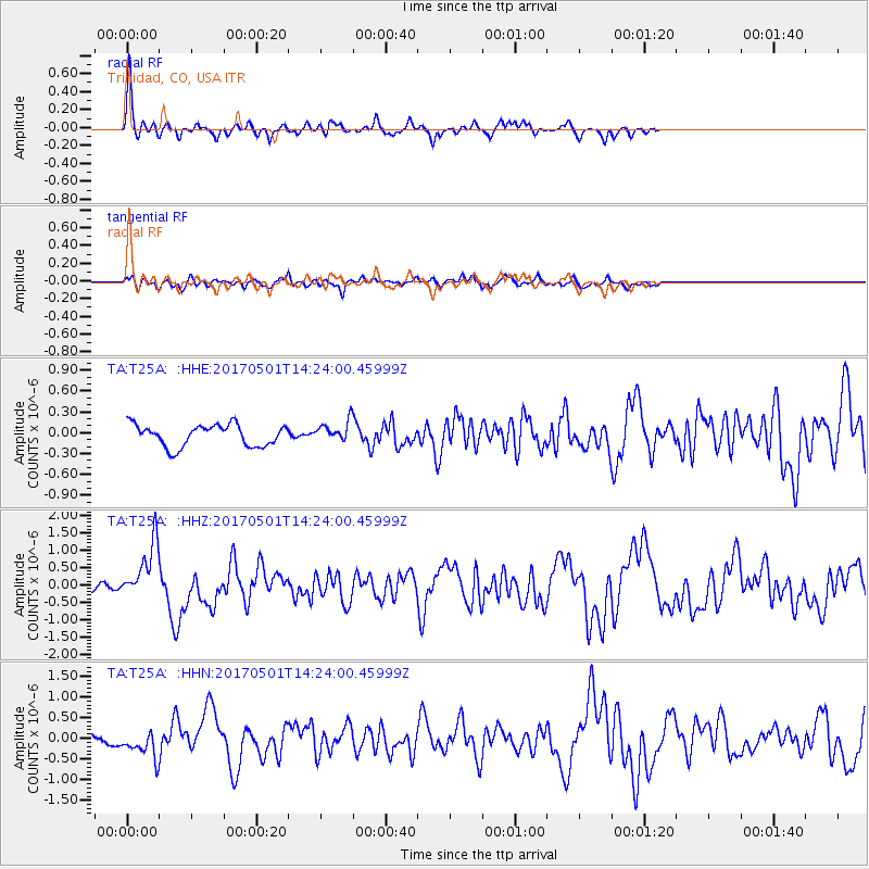
T25A Trinidad, CO, USA - Earthquake Result Viewer
*The percent match for this event was below the threshold and hence no stack was calculated.
| Earthquake location: |
Southeastern Alaska |
| Earthquake latitude/longitude: |
59.8/-136.6 |
| Earthquake time(UTC): |
2017/05/01 (121) 14:18:15 GMT |
| Earthquake Depth: |
3.3 km |
| Earthquake Magnitude: |
6.3 Ml |
| Earthquake Catalog/Contributor: |
NEIC PDE/ak |
|
| Network: |
TA USArray Transportable Network (new EarthScope stations) |
| Station: |
T25A Trinidad, CO, USA |
| Lat/Lon: |
37.14 N/104.41 W |
| Elevation: |
2017 m |
|
| Distance: |
30.7 deg |
| Az: |
123.34 deg |
| Baz: |
328.147 deg |
| Ray Param: |
$rayparam |
*The percent match for this event was below the threshold and hence was not used in the summary stack. |
|
| Radial Match: |
77.81406 % |
| Radial Bump: |
294 |
| Transverse Match: |
60.7067 % |
| Transverse Bump: |
400 |
| SOD ConfigId: |
11737051 |
| Insert Time: |
2019-04-27 06:35:28.803 +0000 |
| GWidth: |
2.5 |
| Max Bumps: |
400 |
| Tol: |
0.001 |
|
Signal To Noise
| Channel | StoN | STA | LTA |
| TA:T25A: :HHZ:20170501T14:24:00.45999Z | 4.935244 | 8.3550384E-7 | 1.6929333E-7 |
| TA:T25A: :HHN:20170501T14:24:00.45999Z | 1.9105889 | 3.3109964E-7 | 1.7329717E-7 |
| TA:T25A: :HHE:20170501T14:24:00.45999Z | 0.837027 | 1.3028581E-7 | 1.5565305E-7 |
| Arrivals |
| Ps | |
| PpPs | |
| PsPs/PpSs | |


