You are here: Home > Network List > TA - USArray Transportable Network (new EarthScope stations) Stations List
> Station Y22D IRIS PASSCAL Instrument Center, Socorro, NM, USA > Earthquake Result Viewer
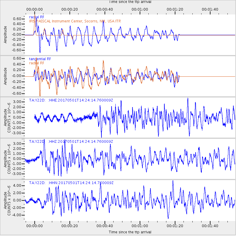
Y22D IRIS PASSCAL Instrument Center, Socorro, NM, USA - Earthquake Result Viewer
*The percent match for this event was below the threshold and hence no stack was calculated.
| Earthquake location: |
Southeastern Alaska |
| Earthquake latitude/longitude: |
59.8/-136.6 |
| Earthquake time(UTC): |
2017/05/01 (121) 14:18:15 GMT |
| Earthquake Depth: |
3.3 km |
| Earthquake Magnitude: |
6.3 Ml |
| Earthquake Catalog/Contributor: |
NEIC PDE/ak |
|
| Network: |
TA USArray Transportable Network (new EarthScope stations) |
| Station: |
Y22D IRIS PASSCAL Instrument Center, Socorro, NM, USA |
| Lat/Lon: |
34.08 N/106.92 W |
| Elevation: |
1436 m |
|
| Distance: |
32.3 deg |
| Az: |
129.649 deg |
| Baz: |
332.075 deg |
| Ray Param: |
$rayparam |
*The percent match for this event was below the threshold and hence was not used in the summary stack. |
|
| Radial Match: |
72.16568 % |
| Radial Bump: |
400 |
| Transverse Match: |
62.37663 % |
| Transverse Bump: |
400 |
| SOD ConfigId: |
11737051 |
| Insert Time: |
2019-04-27 06:35:30.224 +0000 |
| GWidth: |
2.5 |
| Max Bumps: |
400 |
| Tol: |
0.001 |
|
Signal To Noise
| Channel | StoN | STA | LTA |
| TA:Y22D: :HHZ:20170501T14:24:14.760009Z | 2.76739 | 6.755457E-7 | 2.4410932E-7 |
| TA:Y22D: :HHN:20170501T14:24:14.760009Z | 1.4806108 | 8.288456E-7 | 5.597998E-7 |
| TA:Y22D: :HHE:20170501T14:24:14.760009Z | 0.9081892 | 4.4541108E-7 | 4.9043865E-7 |
| Arrivals |
| Ps | |
| PpPs | |
| PsPs/PpSs | |


