You are here: Home > Network List > TX - Texas Seismological Network Stations List
> Station FW12 Venus > Earthquake Result Viewer
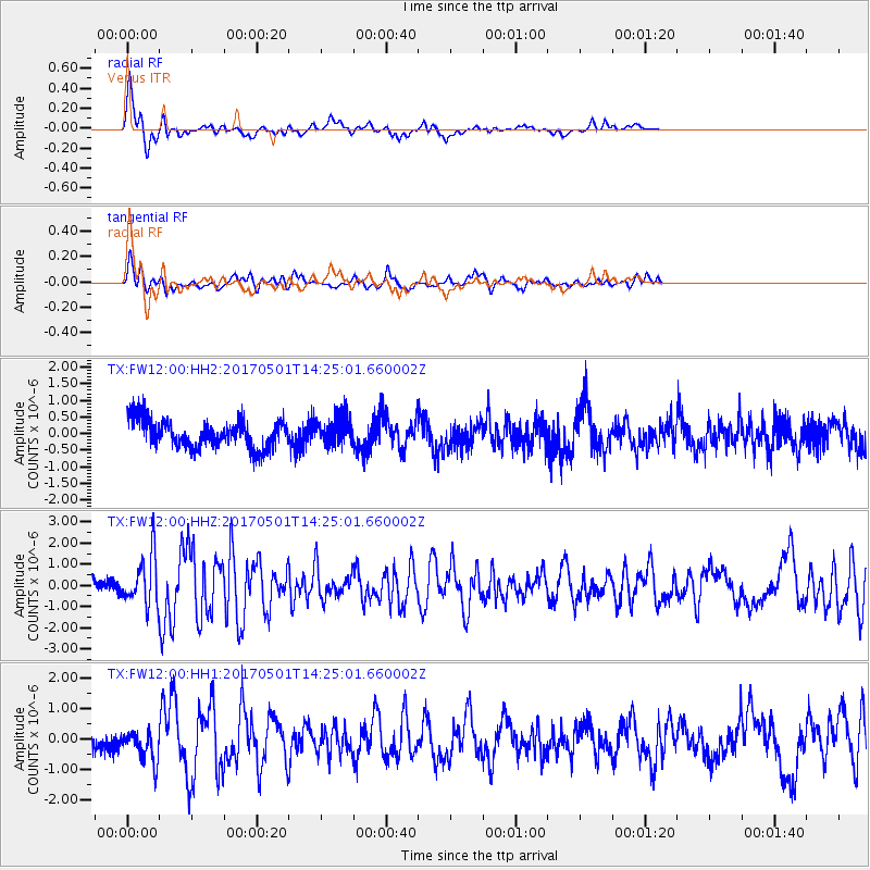
FW12 Venus - Earthquake Result Viewer

| Earthquake location: |
Southeastern Alaska |
| Earthquake latitude/longitude: |
59.8/-136.6 |
| Earthquake time(UTC): |
2017/05/01 (121) 14:18:15 GMT |
| Earthquake Depth: |
3.3 km |
| Earthquake Magnitude: |
6.3 Ml |
| Earthquake Catalog/Contributor: |
NEIC PDE/ak |
|
| Network: |
TX Texas Seismological Network |
| Station: |
FW12 Venus |
| Lat/Lon: |
32.50 N/97.15 W |
| Elevation: |
204 m |
|
| Distance: |
37.7 deg |
| Az: |
118.626 deg |
| Baz: |
328.374 deg |
| Ray Param: |
0.07598849 |
| Estimated Moho Depth: |
69.75 km |
| Estimated Crust Vp/Vs: |
2.04 |
| Assumed Crust Vp: |
6.38 km/s |
| Estimated Crust Vs: |
3.132 km/s |
| Estimated Crust Poisson's Ratio: |
0.34 |
|
| Radial Match: |
86.6493 % |
| Radial Bump: |
375 |
| Transverse Match: |
68.005775 % |
| Transverse Bump: |
400 |
| SOD ConfigId: |
11737051 |
| Insert Time: |
2019-04-27 06:35:48.855 +0000 |
| GWidth: |
2.5 |
| Max Bumps: |
400 |
| Tol: |
0.001 |
|
Signal To Noise
| Channel | StoN | STA | LTA |
| TX:FW12:00:HHZ:20170501T14:25:01.660002Z | 3.9429982 | 1.1491182E-6 | 2.9143263E-7 |
| TX:FW12:00:HH1:20170501T14:25:01.660002Z | 1.9356731 | 5.241404E-7 | 2.7077937E-7 |
| TX:FW12:00:HH2:20170501T14:25:01.660002Z | 0.99612814 | 4.2338763E-7 | 4.250333E-7 |
| Arrivals |
| Ps | 12 SECOND |
| PpPs | 31 SECOND |
| PsPs/PpSs | 43 SECOND |


