You are here: Home > Network List > GS - US Geological Survey Networks Stations List
> Station KAN11 Stewart Ranch, Harper County, KS, USA > Earthquake Result Viewer
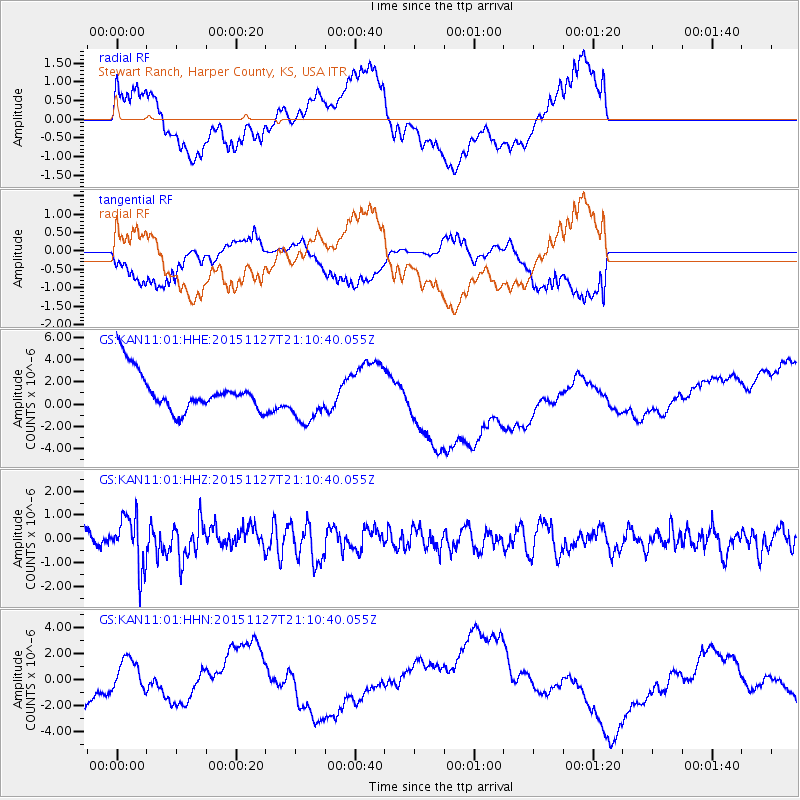
KAN11 Stewart Ranch, Harper County, KS, USA - Earthquake Result Viewer
*The percent match for this event was below the threshold and hence no stack was calculated.
| Earthquake location: |
Near Coast Of Northern Chile |
| Earthquake latitude/longitude: |
-24.8/-70.6 |
| Earthquake time(UTC): |
2015/11/27 (331) 21:00:22 GMT |
| Earthquake Depth: |
35 km |
| Earthquake Magnitude: |
6.2 MWW, 6.2 MWB |
| Earthquake Catalog/Contributor: |
NEIC PDE/NEIC COMCAT |
|
| Network: |
GS US Geological Survey Networks |
| Station: |
KAN11 Stewart Ranch, Harper County, KS, USA |
| Lat/Lon: |
37.21 N/97.91 W |
| Elevation: |
410 m |
|
| Distance: |
66.8 deg |
| Az: |
336.542 deg |
| Baz: |
153.059 deg |
| Ray Param: |
$rayparam |
*The percent match for this event was below the threshold and hence was not used in the summary stack. |
|
| Radial Match: |
39.79042 % |
| Radial Bump: |
400 |
| Transverse Match: |
36.502674 % |
| Transverse Bump: |
318 |
| SOD ConfigId: |
1259291 |
| Insert Time: |
2015-12-11 21:57:23.950 +0000 |
| GWidth: |
2.5 |
| Max Bumps: |
400 |
| Tol: |
0.001 |
|
Signal To Noise
| Channel | StoN | STA | LTA |
| GS:KAN11:01:HHZ:20151127T21:10:40.055Z | 3.455315 | 1.0776711E-6 | 3.1188793E-7 |
| GS:KAN11:01:HHN:20151127T21:10:40.055Z | 0.69476366 | 1.3737018E-6 | 1.9772217E-6 |
| GS:KAN11:01:HHE:20151127T21:10:40.055Z | 1.2736845 | 2.2034938E-6 | 1.7300154E-6 |
| Arrivals |
| Ps | |
| PpPs | |
| PsPs/PpSs | |


