You are here: Home > Network List > TA - USArray Transportable Network (new EarthScope stations) Stations List
> Station D23K Nanushuk River, AK USA > Earthquake Result Viewer
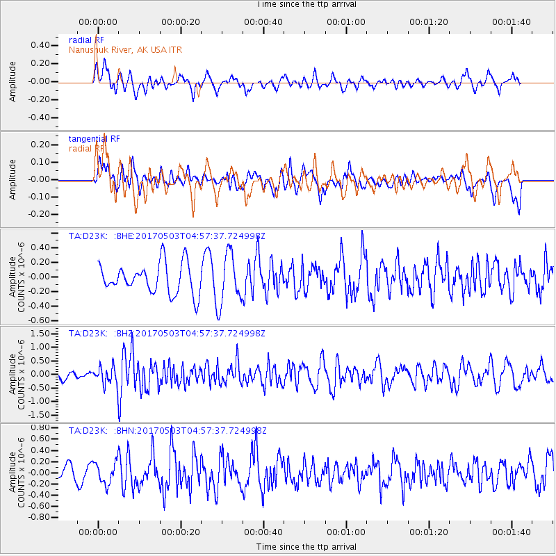
D23K Nanushuk River, AK USA - Earthquake Result Viewer
*The percent match for this event was below the threshold and hence no stack was calculated.
| Earthquake location: |
Tajikistan |
| Earthquake latitude/longitude: |
39.5/71.4 |
| Earthquake time(UTC): |
2017/05/03 (123) 04:47:13 GMT |
| Earthquake Depth: |
10 km |
| Earthquake Magnitude: |
5.9 Mww |
| Earthquake Catalog/Contributor: |
NEIC PDE/us |
|
| Network: |
TA USArray Transportable Network (new EarthScope stations) |
| Station: |
D23K Nanushuk River, AK USA |
| Lat/Lon: |
68.97 N/150.68 W |
| Elevation: |
406 m |
|
| Distance: |
67.4 deg |
| Az: |
15.19 deg |
| Baz: |
325.845 deg |
| Ray Param: |
$rayparam |
*The percent match for this event was below the threshold and hence was not used in the summary stack. |
|
| Radial Match: |
57.78183 % |
| Radial Bump: |
400 |
| Transverse Match: |
51.833977 % |
| Transverse Bump: |
400 |
| SOD ConfigId: |
11737051 |
| Insert Time: |
2019-04-27 06:49:31.742 +0000 |
| GWidth: |
2.5 |
| Max Bumps: |
400 |
| Tol: |
0.001 |
|
Signal To Noise
| Channel | StoN | STA | LTA |
| TA:D23K: :BHZ:20170503T04:57:37.724998Z | 2.1131442 | 3.3903478E-7 | 1.604409E-7 |
| TA:D23K: :BHN:20170503T04:57:37.724998Z | 0.855715 | 1.9596662E-7 | 2.2900922E-7 |
| TA:D23K: :BHE:20170503T04:57:37.724998Z | 1.6006391 | 3.2683513E-7 | 2.041904E-7 |
| Arrivals |
| Ps | |
| PpPs | |
| PsPs/PpSs | |


