You are here: Home > Network List > TA - USArray Transportable Network (new EarthScope stations) Stations List
> Station V15A Kaibab National Forest USFS, William, AZ, USA > Earthquake Result Viewer
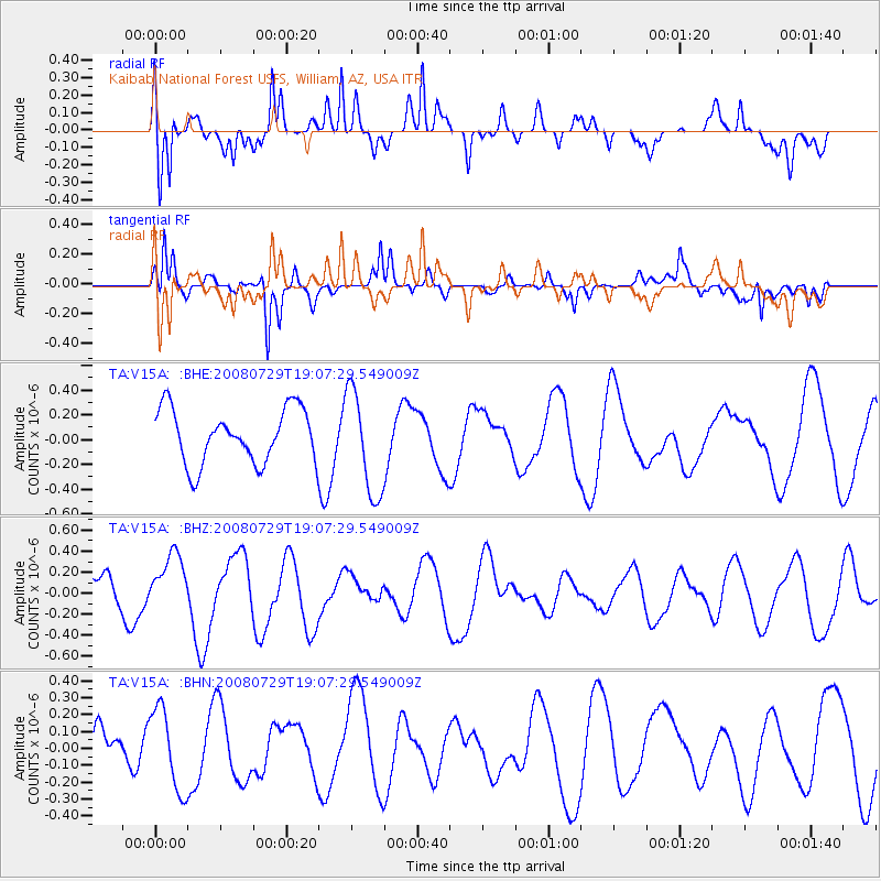
V15A Kaibab National Forest USFS, William, AZ, USA - Earthquake Result Viewer
*The percent match for this event was below the threshold and hence no stack was calculated.
| Earthquake location: |
New Ireland Region, P.N.G. |
| Earthquake latitude/longitude: |
-2.7/152.7 |
| Earthquake time(UTC): |
2008/07/29 (211) 18:54:35 GMT |
| Earthquake Depth: |
10 km |
| Earthquake Magnitude: |
5.5 MB, 5.1 MS, 5.2 MW |
| Earthquake Catalog/Contributor: |
WHDF/NEIC |
|
| Network: |
TA USArray Transportable Network (new EarthScope stations) |
| Station: |
V15A Kaibab National Forest USFS, William, AZ, USA |
| Lat/Lon: |
35.82 N/112.17 W |
| Elevation: |
1891 m |
|
| Distance: |
95.7 deg |
| Az: |
54.44 deg |
| Baz: |
270.853 deg |
| Ray Param: |
$rayparam |
*The percent match for this event was below the threshold and hence was not used in the summary stack. |
|
| Radial Match: |
65.21183 % |
| Radial Bump: |
400 |
| Transverse Match: |
65.79275 % |
| Transverse Bump: |
400 |
| SOD ConfigId: |
2504 |
| Insert Time: |
2010-03-05 23:35:36.448 +0000 |
| GWidth: |
2.5 |
| Max Bumps: |
400 |
| Tol: |
0.001 |
|
Signal To Noise
| Channel | StoN | STA | LTA |
| TA:V15A: :BHZ:20080729T19:07:29.549009Z | 1.7720234 | 2.7438765E-7 | 1.5484424E-7 |
| TA:V15A: :BHN:20080729T19:07:29.549009Z | 1.5109882 | 2.4229314E-7 | 1.6035409E-7 |
| TA:V15A: :BHE:20080729T19:07:29.549009Z | 1.9459614 | 4.2435542E-7 | 2.1806981E-7 |
| Arrivals |
| Ps | |
| PpPs | |
| PsPs/PpSs | |


