You are here: Home > Network List > TA - USArray Transportable Network (new EarthScope stations) Stations List
> Station 531A Rocksprings, TX, USA > Earthquake Result Viewer
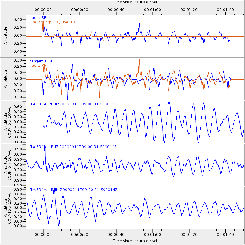
531A Rocksprings, TX, USA - Earthquake Result Viewer
*The percent match for this event was below the threshold and hence no stack was calculated.
| Earthquake location: |
Kuril Islands |
| Earthquake latitude/longitude: |
48.3/154.2 |
| Earthquake time(UTC): |
2009/09/11 (254) 08:49:11 GMT |
| Earthquake Depth: |
35 km |
| Earthquake Magnitude: |
5.8 MB, 5.0 MS, 5.6 MW, 5.6 MW |
| Earthquake Catalog/Contributor: |
WHDF/NEIC |
|
| Network: |
TA USArray Transportable Network (new EarthScope stations) |
| Station: |
531A Rocksprings, TX, USA |
| Lat/Lon: |
30.16 N/100.55 W |
| Elevation: |
661 m |
|
| Distance: |
77.3 deg |
| Az: |
58.948 deg |
| Baz: |
318.655 deg |
| Ray Param: |
$rayparam |
*The percent match for this event was below the threshold and hence was not used in the summary stack. |
|
| Radial Match: |
61.85867 % |
| Radial Bump: |
350 |
| Transverse Match: |
64.6113 % |
| Transverse Bump: |
378 |
| SOD ConfigId: |
2622 |
| Insert Time: |
2010-03-05 23:36:15.989 +0000 |
| GWidth: |
2.5 |
| Max Bumps: |
400 |
| Tol: |
0.001 |
|
Signal To Noise
| Channel | StoN | STA | LTA |
| TA:531A: :BHZ:20090911T09:00:31.699014Z | 1.1880136 | 3.6151485E-7 | 3.0430195E-7 |
| TA:531A: :BHN:20090911T09:00:31.699014Z | 1.8897719 | 3.805909E-7 | 2.0139515E-7 |
| TA:531A: :BHE:20090911T09:00:31.699014Z | 1.0440831 | 2.1427645E-7 | 2.052293E-7 |
| Arrivals |
| Ps | |
| PpPs | |
| PsPs/PpSs | |


