You are here: Home > Network List > US - United States National Seismic Network Stations List
> Station CBKS Cedar Bluff, Kansas, USA > Earthquake Result Viewer
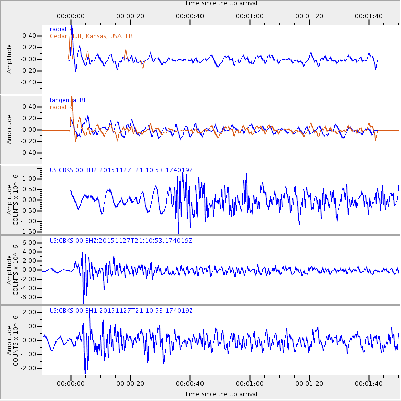
CBKS Cedar Bluff, Kansas, USA - Earthquake Result Viewer
*The percent match for this event was below the threshold and hence no stack was calculated.
| Earthquake location: |
Near Coast Of Northern Chile |
| Earthquake latitude/longitude: |
-24.8/-70.6 |
| Earthquake time(UTC): |
2015/11/27 (331) 21:00:22 GMT |
| Earthquake Depth: |
35 km |
| Earthquake Magnitude: |
6.2 MWW, 6.2 MWB |
| Earthquake Catalog/Contributor: |
NEIC PDE/NEIC COMCAT |
|
| Network: |
US United States National Seismic Network |
| Station: |
CBKS Cedar Bluff, Kansas, USA |
| Lat/Lon: |
38.81 N/99.74 W |
| Elevation: |
677 m |
|
| Distance: |
68.9 deg |
| Az: |
335.967 deg |
| Baz: |
151.724 deg |
| Ray Param: |
$rayparam |
*The percent match for this event was below the threshold and hence was not used in the summary stack. |
|
| Radial Match: |
61.884205 % |
| Radial Bump: |
400 |
| Transverse Match: |
65.5557 % |
| Transverse Bump: |
400 |
| SOD ConfigId: |
1259291 |
| Insert Time: |
2015-12-11 22:05:31.740 +0000 |
| GWidth: |
2.5 |
| Max Bumps: |
400 |
| Tol: |
0.001 |
|
Signal To Noise
| Channel | StoN | STA | LTA |
| US:CBKS:00:BHZ:20151127T21:10:53.174019Z | 8.668145 | 2.109267E-6 | 2.4333542E-7 |
| US:CBKS:00:BH1:20151127T21:10:53.174019Z | 2.2828493 | 6.576653E-7 | 2.8808964E-7 |
| US:CBKS:00:BH2:20151127T21:10:53.174019Z | 1.7791665 | 4.2350806E-7 | 2.3803733E-7 |
| Arrivals |
| Ps | |
| PpPs | |
| PsPs/PpSs | |


