432A Menard, TX, USA - Earthquake Result Viewer
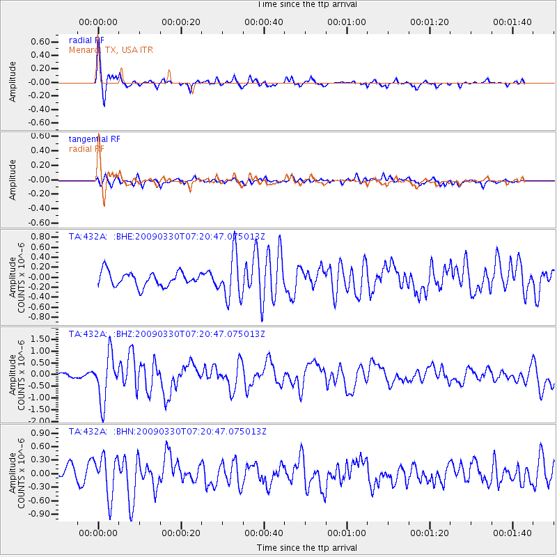
Earthquake location: Kodiak Island Region, Alaska
Earthquake latitude/longitude: 56.5/-152.7
Earthquake time(UTC): 2009/03/30 (089) 07:13:07 GMT
Earthquake Depth: 21 km
Earthquake Magnitude: 5.9 MB, 5.9 MS, 5.9 MW, 5.9 MW
Earthquake Catalog/Contributor: WHDF/NEIC
Network: TA USArray Transportable Network (new EarthScope stations)
Station: 432A Menard, TX, USA
Lat/Lon: 30.88 N/99.79 W
Elevation: 647 m
Distance: 44.6 deg
Az: 102.213 deg
Baz: 320.981 deg
Ray Param: 0.071791306
Estimated Moho Depth: 43.5 km
Estimated Crust Vp/Vs: 1.74
Assumed Crust Vp: 6.498 km/s
Estimated Crust Vs: 3.745 km/s
Estimated Crust Poisson's Ratio: 0.25
Radial Match: 84.74906 %
Radial Bump: 333
Transverse Match: 59.198788 %
Transverse Bump: 400
SOD ConfigId: 2658
Insert Time: 2010-03-05 23:37:00.597 +0000
GWidth: 2.5
Max Bumps: 400
Tol: 0.001

Signal To Noise

ChannelStoNSTALTA
TA:432A: :BHZ:20090330T07:20:47.075013Z8.8417971.0202663E-61.1539128E-7
TA:432A: :BHN:20090330T07:20:47.075013Z4.2237724.5839394E-71.0852715E-7
TA:432A: :BHE:20090330T07:20:47.075013Z3.22424534.5332274E-71.4059809E-7
Arrivals
Ps5.3 SECOND
PpPs17 SECOND
PsPs/PpSs22 SECOND