You are here: Home > Network List > UU - University of Utah Regional Network Stations List
> Station CCUT Cedar City, UT, USA > Earthquake Result Viewer
CCUT Cedar City, UT, USA - Earthquake Result Viewer
*The percent match for this event was below the threshold and hence no stack was calculated.
| Earthquake location: |
Near Coast Of Northern Chile |
| Earthquake latitude/longitude: |
-24.8/-70.6 |
| Earthquake time(UTC): |
2015/11/27 (331) 21:00:22 GMT |
| Earthquake Depth: |
35 km |
| Earthquake Magnitude: |
6.2 MWW, 6.2 MWB |
| Earthquake Catalog/Contributor: |
NEIC PDE/NEIC COMCAT |
|
| Network: |
UU University of Utah Regional Network |
| Station: |
CCUT Cedar City, UT, USA |
| Lat/Lon: |
37.55 N/113.36 W |
| Elevation: |
2127 m |
|
| Distance: |
73.9 deg |
| Az: |
325.854 deg |
| Baz: |
140.077 deg |
| Ray Param: |
$rayparam |
*The percent match for this event was below the threshold and hence was not used in the summary stack. |
|
| Radial Match: |
62.488647 % |
| Radial Bump: |
396 |
| Transverse Match: |
61.09191 % |
| Transverse Bump: |
400 |
| SOD ConfigId: |
1259291 |
| Insert Time: |
2015-12-11 22:09:13.780 +0000 |
| GWidth: |
2.5 |
| Max Bumps: |
400 |
| Tol: |
0.001 |
|
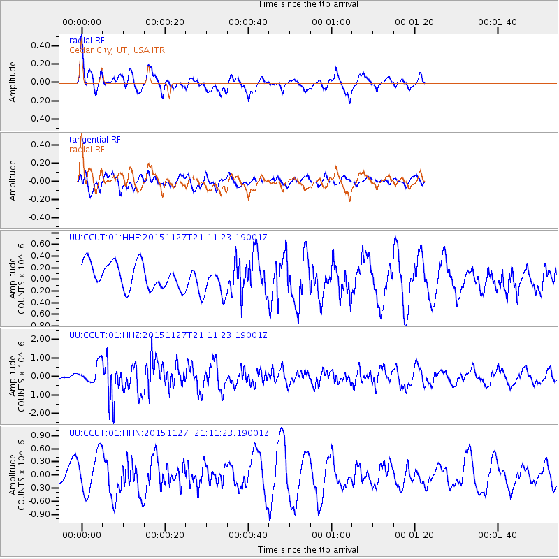
Signal To Noise
| Channel | StoN | STA | LTA |
| UU:CCUT:01:HHZ:20151127T21:11:23.19001Z | 4.3511767 | 5.319356E-7 | 1.2225097E-7 |
| UU:CCUT:01:HHN:20151127T21:11:23.19001Z | 2.7938876 | 4.6315077E-7 | 1.6577287E-7 |
| UU:CCUT:01:HHE:20151127T21:11:23.19001Z | 1.2159036 | 2.6471383E-7 | 2.1770956E-7 |
| Arrivals |
| Ps | |
| PpPs | |
| PsPs/PpSs | |


