You are here: Home > Network List > UW - Pacific Northwest Regional Seismic Network Stations List
> Station LEBA Lebam, WA, USA > Earthquake Result Viewer
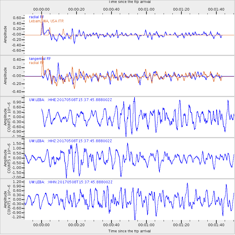
LEBA Lebam, WA, USA - Earthquake Result Viewer
*The percent match for this event was below the threshold and hence no stack was calculated.
| Earthquake location: |
Andreanof Islands, Aleutian Is. |
| Earthquake latitude/longitude: |
51.1/-177.0 |
| Earthquake time(UTC): |
2017/05/08 (128) 15:31:28 GMT |
| Earthquake Depth: |
41 km |
| Earthquake Magnitude: |
5.5 Ml |
| Earthquake Catalog/Contributor: |
NEIC PDE/ak |
|
| Network: |
UW Pacific Northwest Regional Seismic Network |
| Station: |
LEBA Lebam, WA, USA |
| Lat/Lon: |
46.55 N/123.56 W |
| Elevation: |
73 m |
|
| Distance: |
34.8 deg |
| Az: |
76.052 deg |
| Baz: |
297.476 deg |
| Ray Param: |
$rayparam |
*The percent match for this event was below the threshold and hence was not used in the summary stack. |
|
| Radial Match: |
63.58994 % |
| Radial Bump: |
400 |
| Transverse Match: |
63.8361 % |
| Transverse Bump: |
400 |
| SOD ConfigId: |
11737051 |
| Insert Time: |
2019-04-27 07:18:31.259 +0000 |
| GWidth: |
2.5 |
| Max Bumps: |
400 |
| Tol: |
0.001 |
|
Signal To Noise
| Channel | StoN | STA | LTA |
| UW:LEBA: :HHZ:20170508T15:37:45.888002Z | 2.0896716 | 4.4730595E-7 | 2.1405563E-7 |
| UW:LEBA: :HHN:20170508T15:37:45.888002Z | 1.3140755 | 3.275165E-7 | 2.492372E-7 |
| UW:LEBA: :HHE:20170508T15:37:45.888002Z | 1.2077379 | 3.2484337E-7 | 2.6896842E-7 |
| Arrivals |
| Ps | |
| PpPs | |
| PsPs/PpSs | |


