You are here: Home > Network List > TA - USArray Transportable Network (new EarthScope stations) Stations List
> Station 226B Tecolote Peak, Malaga, NM, USA > Earthquake Result Viewer
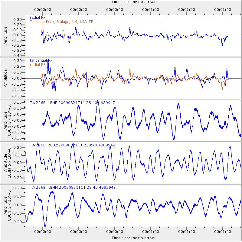
226B Tecolote Peak, Malaga, NM, USA - Earthquake Result Viewer
*The percent match for this event was below the threshold and hence no stack was calculated.
| Earthquake location: |
Southeast Of Loyalty Islands |
| Earthquake latitude/longitude: |
-22.5/171.2 |
| Earthquake time(UTC): |
2009/08/21 (233) 11:15:39 GMT |
| Earthquake Depth: |
10 km |
| Earthquake Magnitude: |
5.7 MW, 5.2 MS, 5.2 MB, 5.6 MW |
| Earthquake Catalog/Contributor: |
WHDF/NEIC |
|
| Network: |
TA USArray Transportable Network (new EarthScope stations) |
| Station: |
226B Tecolote Peak, Malaga, NM, USA |
| Lat/Lon: |
32.08 N/104.17 W |
| Elevation: |
981 m |
|
| Distance: |
97.3 deg |
| Az: |
58.442 deg |
| Baz: |
248.124 deg |
| Ray Param: |
$rayparam |
*The percent match for this event was below the threshold and hence was not used in the summary stack. |
|
| Radial Match: |
64.35423 % |
| Radial Bump: |
377 |
| Transverse Match: |
83.2338 % |
| Transverse Bump: |
357 |
| SOD ConfigId: |
2622 |
| Insert Time: |
2010-03-05 23:38:19.281 +0000 |
| GWidth: |
2.5 |
| Max Bumps: |
400 |
| Tol: |
0.001 |
|
Signal To Noise
| Channel | StoN | STA | LTA |
| TA:226B: :BHZ:20090821T11:28:40.498994Z | 0.36175257 | 5.3510153E-8 | 1.479192E-7 |
| TA:226B: :BHN:20090821T11:28:40.498994Z | 1.2170286 | 1.3764748E-7 | 1.1310127E-7 |
| TA:226B: :BHE:20090821T11:28:40.498994Z | 2.1111677 | 1.0670481E-7 | 5.0543026E-8 |
| Arrivals |
| Ps | |
| PpPs | |
| PsPs/PpSs | |


