You are here: Home > Network List > TA - USArray Transportable Network (new EarthScope stations) Stations List
> Station 226B Tecolote Peak, Malaga, NM, USA > Earthquake Result Viewer
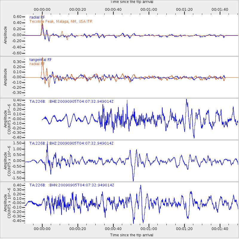
226B Tecolote Peak, Malaga, NM, USA - Earthquake Result Viewer
*The percent match for this event was below the threshold and hence no stack was calculated.
| Earthquake location: |
Southern Peru |
| Earthquake latitude/longitude: |
-15.1/-70.2 |
| Earthquake time(UTC): |
2009/09/05 (248) 03:58:39 GMT |
| Earthquake Depth: |
210 km |
| Earthquake Magnitude: |
5.8 MW, 5.2 MB, 5.8 MW |
| Earthquake Catalog/Contributor: |
WHDF/NEIC |
|
| Network: |
TA USArray Transportable Network (new EarthScope stations) |
| Station: |
226B Tecolote Peak, Malaga, NM, USA |
| Lat/Lon: |
32.08 N/104.17 W |
| Elevation: |
981 m |
|
| Distance: |
57.1 deg |
| Az: |
325.648 deg |
| Baz: |
140.061 deg |
| Ray Param: |
$rayparam |
*The percent match for this event was below the threshold and hence was not used in the summary stack. |
|
| Radial Match: |
77.8586 % |
| Radial Bump: |
400 |
| Transverse Match: |
68.59111 % |
| Transverse Bump: |
400 |
| SOD ConfigId: |
2622 |
| Insert Time: |
2010-03-05 23:38:21.611 +0000 |
| GWidth: |
2.5 |
| Max Bumps: |
400 |
| Tol: |
0.001 |
|
Signal To Noise
| Channel | StoN | STA | LTA |
| TA:226B: :BHZ:20090905T04:07:32.949014Z | 6.0006523 | 5.101548E-7 | 8.501655E-8 |
| TA:226B: :BHN:20090905T04:07:32.949014Z | 2.0463126 | 9.5827296E-8 | 4.6829257E-8 |
| TA:226B: :BHE:20090905T04:07:32.949014Z | 1.7726408 | 1.044796E-7 | 5.894008E-8 |
| Arrivals |
| Ps | |
| PpPs | |
| PsPs/PpSs | |


