You are here: Home > Network List > CI - Caltech Regional Seismic Network Stations List
> Station BFS Mt Baldy Forest Station > Earthquake Result Viewer
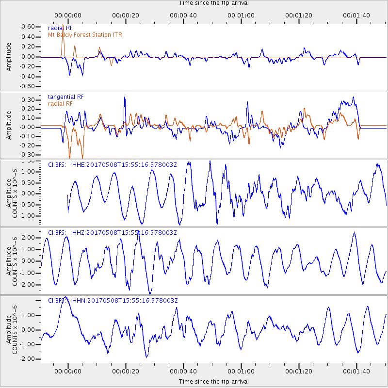
BFS Mt Baldy Forest Station - Earthquake Result Viewer
*The percent match for this event was below the threshold and hence no stack was calculated.
| Earthquake location: |
Andreanof Islands, Aleutian Is. |
| Earthquake latitude/longitude: |
51.0/-177.1 |
| Earthquake time(UTC): |
2017/05/08 (128) 15:47:28 GMT |
| Earthquake Depth: |
1.0 km |
| Earthquake Magnitude: |
5.7 Mi |
| Earthquake Catalog/Contributor: |
NEIC PDE/at |
|
| Network: |
CI Caltech Regional Seismic Network |
| Station: |
BFS Mt Baldy Forest Station |
| Lat/Lon: |
34.24 N/117.66 W |
| Elevation: |
1312 m |
|
| Distance: |
45.5 deg |
| Az: |
87.77 deg |
| Baz: |
310.282 deg |
| Ray Param: |
$rayparam |
*The percent match for this event was below the threshold and hence was not used in the summary stack. |
|
| Radial Match: |
59.438766 % |
| Radial Bump: |
400 |
| Transverse Match: |
73.844345 % |
| Transverse Bump: |
400 |
| SOD ConfigId: |
11737051 |
| Insert Time: |
2019-04-27 07:22:58.889 +0000 |
| GWidth: |
2.5 |
| Max Bumps: |
400 |
| Tol: |
0.001 |
|
Signal To Noise
| Channel | StoN | STA | LTA |
| CI:BFS: :HHZ:20170508T15:55:16.578003Z | 1.5952115 | 1.406511E-6 | 8.8170816E-7 |
| CI:BFS: :HHN:20170508T15:55:16.578003Z | 1.797336 | 1.401006E-6 | 7.7949034E-7 |
| CI:BFS: :HHE:20170508T15:55:16.578003Z | 0.8772028 | 5.638064E-7 | 6.4273206E-7 |
| Arrivals |
| Ps | |
| PpPs | |
| PsPs/PpSs | |


