You are here: Home > Network List > TA - USArray Transportable Network (new EarthScope stations) Stations List
> Station 226B Tecolote Peak, Malaga, NM, USA > Earthquake Result Viewer
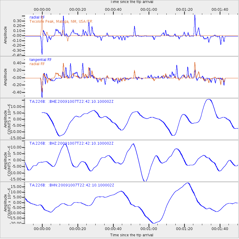
226B Tecolote Peak, Malaga, NM, USA - Earthquake Result Viewer
*The percent match for this event was below the threshold and hence no stack was calculated.
| Earthquake location: |
Santa Cruz Islands |
| Earthquake latitude/longitude: |
-11.5/166.0 |
| Earthquake time(UTC): |
2009/10/07 (280) 22:29:18 GMT |
| Earthquake Depth: |
35 km |
| Earthquake Magnitude: |
5.5 MB |
| Earthquake Catalog/Contributor: |
WHDF/NEIC |
|
| Network: |
TA USArray Transportable Network (new EarthScope stations) |
| Station: |
226B Tecolote Peak, Malaga, NM, USA |
| Lat/Lon: |
32.08 N/104.17 W |
| Elevation: |
981 m |
|
| Distance: |
95.8 deg |
| Az: |
58.58 deg |
| Baz: |
260.159 deg |
| Ray Param: |
$rayparam |
*The percent match for this event was below the threshold and hence was not used in the summary stack. |
|
| Radial Match: |
63.72375 % |
| Radial Bump: |
223 |
| Transverse Match: |
58.254917 % |
| Transverse Bump: |
300 |
| SOD ConfigId: |
2622 |
| Insert Time: |
2010-03-05 23:38:31.719 +0000 |
| GWidth: |
2.5 |
| Max Bumps: |
400 |
| Tol: |
0.001 |
|
Signal To Noise
| Channel | StoN | STA | LTA |
| TA:226B: :BHZ:20091007T22:42:10.100002Z | 0.22673346 | 1.5091706E-6 | 6.6561443E-6 |
| TA:226B: :BHN:20091007T22:42:10.100002Z | 2.6611876 | 8.846565E-6 | 3.324292E-6 |
| TA:226B: :BHE:20091007T22:42:10.100002Z | 0.9719393 | 6.095273E-6 | 6.2712484E-6 |
| Arrivals |
| Ps | |
| PpPs | |
| PsPs/PpSs | |


