You are here: Home > Network List > LD - Lamont-Doherty Cooperative Seismographic Network Stations List
> Station GEDE Greenville, DE, USA > Earthquake Result Viewer
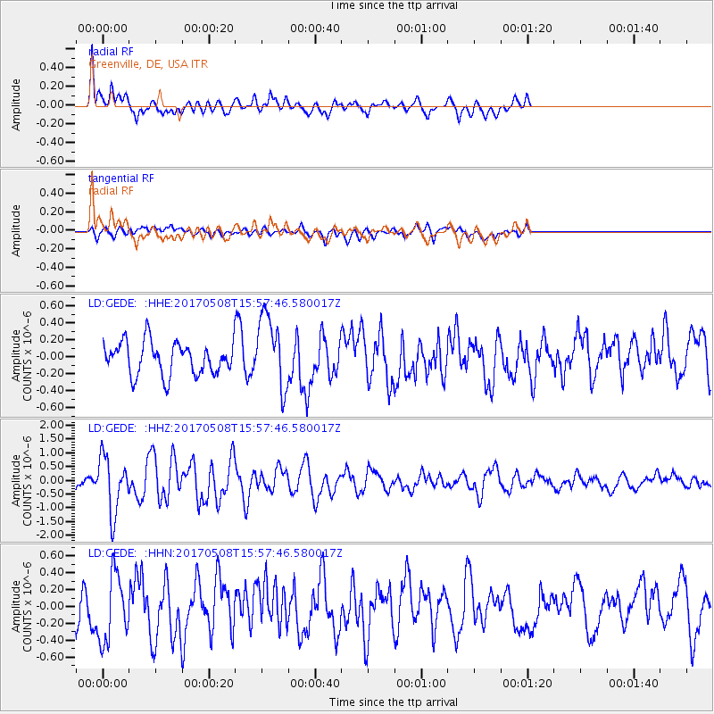
GEDE Greenville, DE, USA - Earthquake Result Viewer
*The percent match for this event was below the threshold and hence no stack was calculated.
| Earthquake location: |
Andreanof Islands, Aleutian Is. |
| Earthquake latitude/longitude: |
51.0/-177.1 |
| Earthquake time(UTC): |
2017/05/08 (128) 15:47:28 GMT |
| Earthquake Depth: |
1.0 km |
| Earthquake Magnitude: |
5.7 Mi |
| Earthquake Catalog/Contributor: |
NEIC PDE/at |
|
| Network: |
LD Lamont-Doherty Cooperative Seismographic Network |
| Station: |
GEDE Greenville, DE, USA |
| Lat/Lon: |
39.81 N/75.64 W |
| Elevation: |
105 m |
|
| Distance: |
66.6 deg |
| Az: |
55.353 deg |
| Baz: |
317.506 deg |
| Ray Param: |
$rayparam |
*The percent match for this event was below the threshold and hence was not used in the summary stack. |
|
| Radial Match: |
68.23892 % |
| Radial Bump: |
400 |
| Transverse Match: |
50.686935 % |
| Transverse Bump: |
400 |
| SOD ConfigId: |
11737051 |
| Insert Time: |
2019-04-27 07:26:05.944 +0000 |
| GWidth: |
2.5 |
| Max Bumps: |
400 |
| Tol: |
0.001 |
|
Signal To Noise
| Channel | StoN | STA | LTA |
| LD:GEDE: :HHZ:20170508T15:57:46.580017Z | 3.7262743 | 1.0331618E-6 | 2.77264E-7 |
| LD:GEDE: :HHN:20170508T15:57:46.580017Z | 1.8580183 | 3.9635677E-7 | 2.1332232E-7 |
| LD:GEDE: :HHE:20170508T15:57:46.580017Z | 1.5696633 | 3.4809864E-7 | 2.2176643E-7 |
| Arrivals |
| Ps | |
| PpPs | |
| PsPs/PpSs | |


