You are here: Home > Network List > GS - US Geological Survey Networks Stations List
> Station KAN11 Stewart Ranch, Harper County, KS, USA > Earthquake Result Viewer
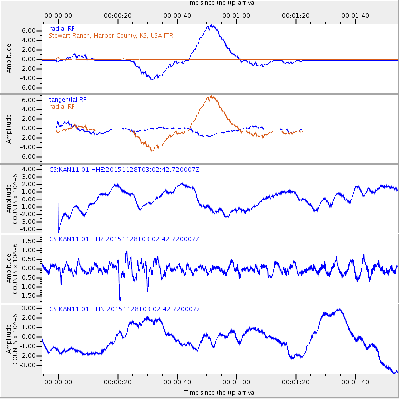
KAN11 Stewart Ranch, Harper County, KS, USA - Earthquake Result Viewer
*The percent match for this event was below the threshold and hence no stack was calculated.
| Earthquake location: |
Kuril Islands |
| Earthquake latitude/longitude: |
43.3/146.5 |
| Earthquake time(UTC): |
2015/11/28 (332) 02:51:06 GMT |
| Earthquake Depth: |
60 km |
| Earthquake Magnitude: |
5.9 MB |
| Earthquake Catalog/Contributor: |
NEIC PDE/NEIC COMCAT |
|
| Network: |
GS US Geological Survey Networks |
| Station: |
KAN11 Stewart Ranch, Harper County, KS, USA |
| Lat/Lon: |
37.21 N/97.91 W |
| Elevation: |
410 m |
|
| Distance: |
80.8 deg |
| Az: |
46.838 deg |
| Baz: |
318.201 deg |
| Ray Param: |
$rayparam |
*The percent match for this event was below the threshold and hence was not used in the summary stack. |
|
| Radial Match: |
30.874393 % |
| Radial Bump: |
400 |
| Transverse Match: |
24.316246 % |
| Transverse Bump: |
400 |
| SOD ConfigId: |
1259291 |
| Insert Time: |
2015-12-12 03:38:41.272 +0000 |
| GWidth: |
2.5 |
| Max Bumps: |
400 |
| Tol: |
0.001 |
|
Signal To Noise
| Channel | StoN | STA | LTA |
| GS:KAN11:01:HHZ:20151128T03:02:42.720007Z | 0.844851 | 2.3372016E-7 | 2.7664066E-7 |
| GS:KAN11:01:HHN:20151128T03:02:42.720007Z | 1.378465 | 2.8471204E-6 | 2.065428E-6 |
| GS:KAN11:01:HHE:20151128T03:02:42.720007Z | 0.29838106 | 4.641804E-7 | 1.555663E-6 |
| Arrivals |
| Ps | |
| PpPs | |
| PsPs/PpSs | |


