You are here: Home > Network List > TA - USArray Transportable Network (new EarthScope stations) Stations List
> Station 530A J-C Ranch, Comstock, TX, USA > Earthquake Result Viewer
530A J-C Ranch, Comstock, TX, USA - Earthquake Result Viewer

| Earthquake location: |
Tonga Islands |
| Earthquake latitude/longitude: |
-20.8/-174.3 |
| Earthquake time(UTC): |
2009/07/30 (211) 20:05:34 GMT |
| Earthquake Depth: |
10 km |
| Earthquake Magnitude: |
5.9 MB, 5.7 MS, 5.8 MW, 5.7 MW |
| Earthquake Catalog/Contributor: |
WHDF/NEIC |
|
| Network: |
TA USArray Transportable Network (new EarthScope stations) |
| Station: |
530A J-C Ranch, Comstock, TX, USA |
| Lat/Lon: |
30.15 N/101.34 W |
| Elevation: |
636 m |
|
| Distance: |
86.5 deg |
| Az: |
56.049 deg |
| Baz: |
243.601 deg |
| Ray Param: |
0.044014428 |
| Estimated Moho Depth: |
69.75 km |
| Estimated Crust Vp/Vs: |
1.66 |
| Assumed Crust Vp: |
6.38 km/s |
| Estimated Crust Vs: |
3.849 km/s |
| Estimated Crust Poisson's Ratio: |
0.21 |
|
| Radial Match: |
90.089386 % |
| Radial Bump: |
279 |
| Transverse Match: |
82.9201 % |
| Transverse Bump: |
400 |
| SOD ConfigId: |
2622 |
| Insert Time: |
2010-03-05 23:38:49.865 +0000 |
| GWidth: |
2.5 |
| Max Bumps: |
400 |
| Tol: |
0.001 |
|
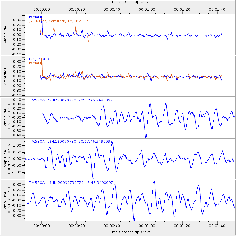
Signal To Noise
| Channel | StoN | STA | LTA |
| TA:530A: :BHZ:20090730T20:17:46.349009Z | 8.862372 | 4.5929664E-7 | 5.1825477E-8 |
| TA:530A: :BHN:20090730T20:17:46.349009Z | 1.2224523 | 5.743987E-8 | 4.698741E-8 |
| TA:530A: :BHE:20090730T20:17:46.349009Z | 2.6870368 | 1.3053949E-7 | 4.858121E-8 |
| Arrivals |
| Ps | 7.4 SECOND |
| PpPs | 28 SECOND |
| PsPs/PpSs | 36 SECOND |


