You are here: Home > Network List > TA - USArray Transportable Network (new EarthScope stations) Stations List
> Station BGNE Belgrade, NE, USA > Earthquake Result Viewer
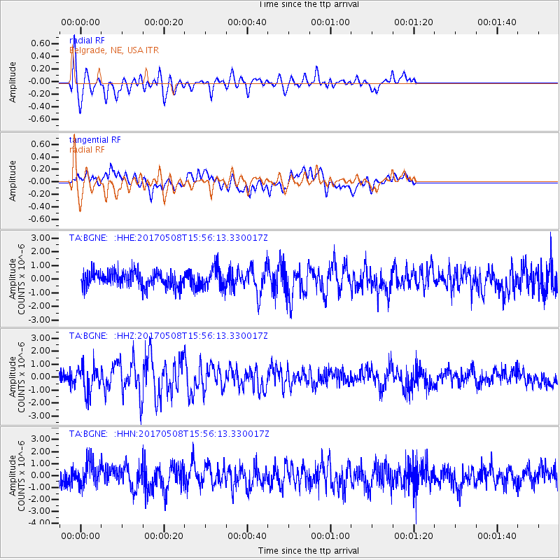
BGNE Belgrade, NE, USA - Earthquake Result Viewer
*The percent match for this event was below the threshold and hence no stack was calculated.
| Earthquake location: |
Andreanof Islands, Aleutian Is. |
| Earthquake latitude/longitude: |
51.0/-177.1 |
| Earthquake time(UTC): |
2017/05/08 (128) 15:47:28 GMT |
| Earthquake Depth: |
1.0 km |
| Earthquake Magnitude: |
5.7 Mi |
| Earthquake Catalog/Contributor: |
NEIC PDE/at |
|
| Network: |
TA USArray Transportable Network (new EarthScope stations) |
| Station: |
BGNE Belgrade, NE, USA |
| Lat/Lon: |
41.41 N/98.15 W |
| Elevation: |
573 m |
|
| Distance: |
53.0 deg |
| Az: |
67.56 deg |
| Baz: |
308.999 deg |
| Ray Param: |
$rayparam |
*The percent match for this event was below the threshold and hence was not used in the summary stack. |
|
| Radial Match: |
80.368835 % |
| Radial Bump: |
400 |
| Transverse Match: |
72.92237 % |
| Transverse Bump: |
400 |
| SOD ConfigId: |
11737051 |
| Insert Time: |
2019-04-27 07:30:46.368 +0000 |
| GWidth: |
2.5 |
| Max Bumps: |
400 |
| Tol: |
0.001 |
|
Signal To Noise
| Channel | StoN | STA | LTA |
| TA:BGNE: :HHZ:20170508T15:56:13.330017Z | 2.1553574 | 1.0109493E-6 | 4.690402E-7 |
| TA:BGNE: :HHN:20170508T15:56:13.330017Z | 1.790542 | 1.0419793E-6 | 5.819351E-7 |
| TA:BGNE: :HHE:20170508T15:56:13.330017Z | 1.5029141 | 8.089011E-7 | 5.382218E-7 |
| Arrivals |
| Ps | |
| PpPs | |
| PsPs/PpSs | |


